YEAR PUBLISHED: 1851
Map of The Operations of The American Army in The Valley of Mexico in August and September 1847
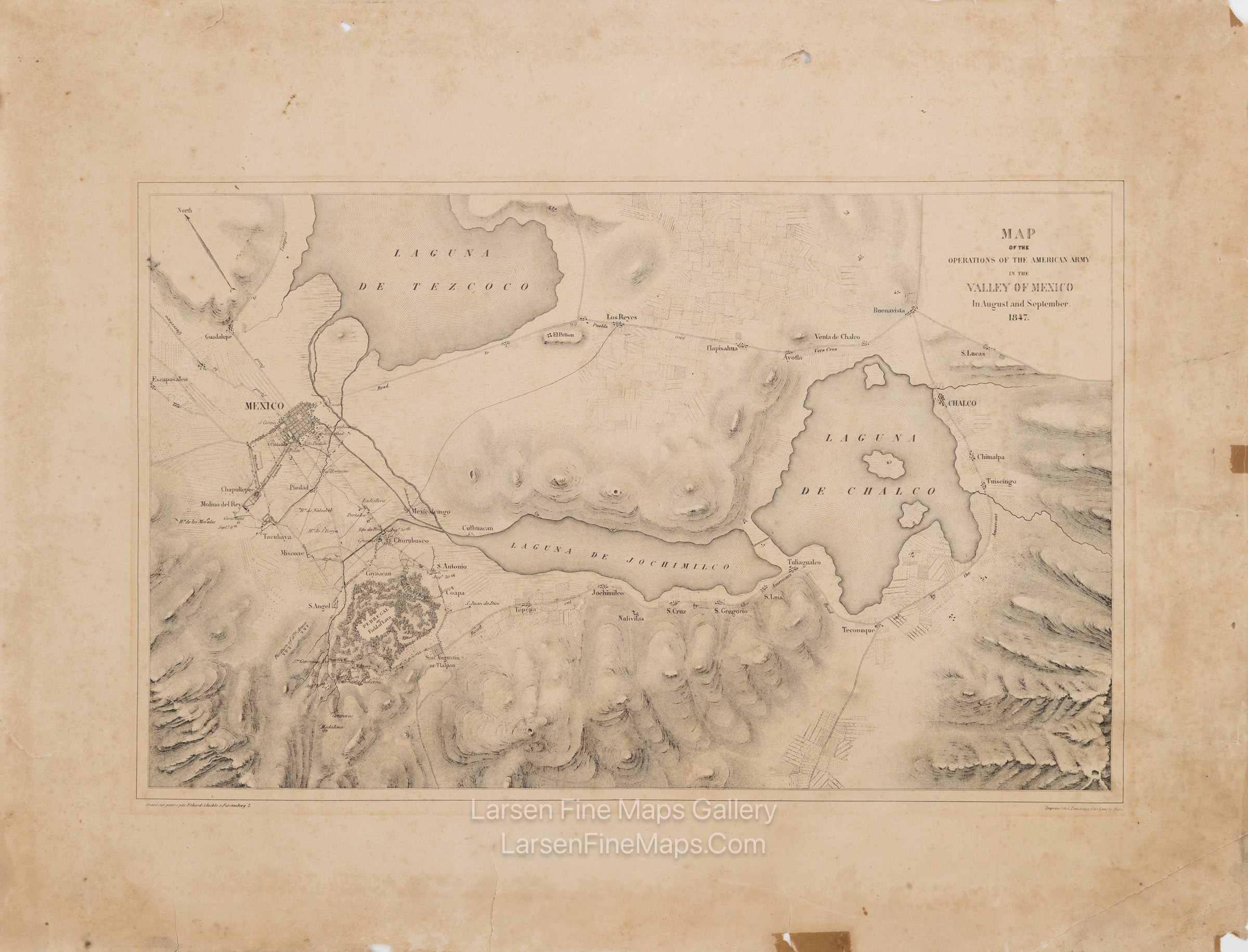
DESCRIPTION
A map of the area surrounding Mexico City during the Mexican-American War (1846 - 1848).
The map depicts the region from Chalco on (Laguna de Chalco) in the east to Mexico City and Churubusco in the west and from Guadalupe and Laguna de Tezcoc in the north down to Teconuque in the south, with Laguna de Jochimilco in the map's center. Lakes, roads, trails, watercourses, and towns throughout the Valley of Mexico are shown. Military positions and notes are given, and a "Pedregal" or field of lava is identified and illustrated. Relief illustrated by hachures.
This map is Plate 6 from "The War between the United States and Mexico illustrated, embracing pictorial drawings of all the principal conflicts, by Carl Nebel, with a description of each battle, by Geo. Wilkins Kendall". A rare map and rare on the market.
FULL TITLE
MAPMAKER/CARTOGRAPHER/AUTHOR
PUBLISHER
PUBLICATION
DIMENSIONS (Inches)
CONDITION
Choose options
DESCRIPTION
FULL TITLE
MAPMAKER/CARTOGRAPHER/AUTHOR
PUBLISHER
PUBLICATION
DIMENSIONS (Inches)
CONDITION
DESCRIPTION
FULL TITLE
MAPMAKER/CARTOGRAPHER/AUTHOR
PUBLISHER
PUBLICATION
DIMENSIONS (Inches)
CONDITION