
YEAR PUBLISHED: 1806
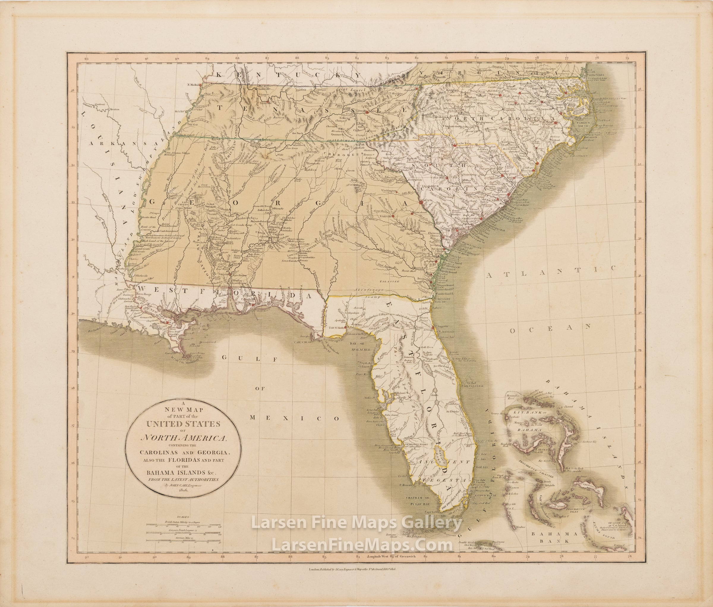
A New Map of Part of the United States of North America, Containing The Carolinas and Georgia, Also The Floridas and Part of the Bahama Islands &c
DESCRIPTION
A striking and desirable example of John Cary's map of the southeast to the Mississippi River shows East and West Florida, an extensive Georgia, North and South Carolina, Tennessee, and a small portion of Virginia. The map also depicts some of the Bahama Islands. Water features are shown fairly extensively, along with some roads, place names, and interesting notes scattered around the map. Primary mountains are shown pictorially, and major towns/cities are highlighted in red. The map defines an exciting period in the history of this region and is a must-have for collectors.
FULL TITLE
MAPMAKER/CARTOGRAPHER/AUTHOR
PUBLISHER
PUBLICATION
DIMENSIONS (Inches)
CONDITION
Choose options

DESCRIPTION
FULL TITLE
MAPMAKER/CARTOGRAPHER/AUTHOR
PUBLISHER
PUBLICATION
DIMENSIONS (Inches)
CONDITION
DESCRIPTION
FULL TITLE
MAPMAKER/CARTOGRAPHER/AUTHOR
PUBLISHER
PUBLICATION
DIMENSIONS (Inches)
CONDITION