YEAR PUBLISHED: 1864
Newport Harbor and Approaches Rhode Island
DESCRIPTION
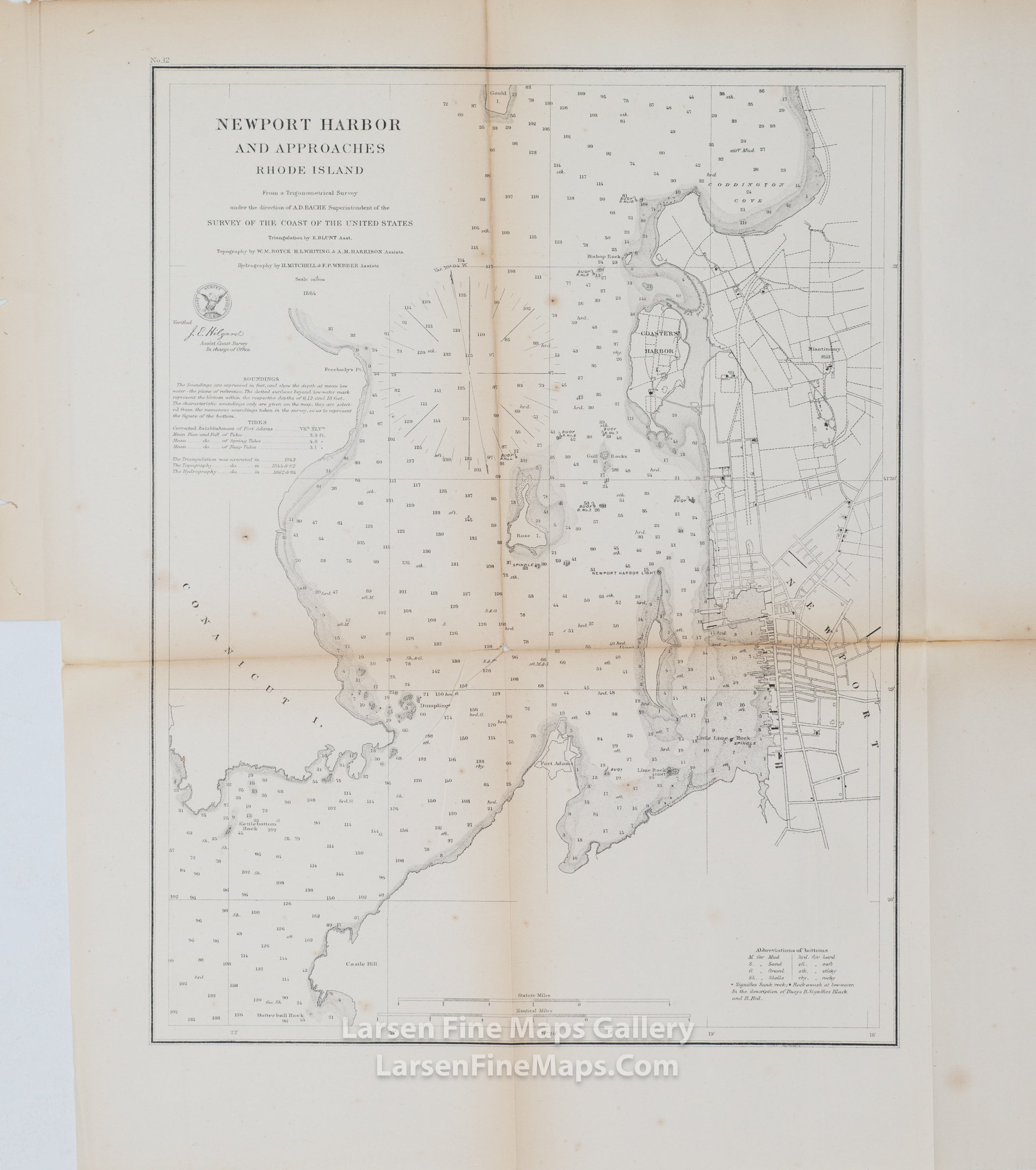
A striking U.S. Coast Survey chart showing numerous soundings, aids and hazards to navigation, points, rocks, islands, lighthouses, bearings, and headings along with notes on tides and soundings. This chart includes significant terrestrial details, showing roads, buildings, properties, vegetation, placees etc. Depicted are Conanicut Island, Castle Hill, the town of Newport, Coasters Harbor Island, and Coddington Cove.
IMPORTANT NOTE:
All of our United States Coast Survey (USCS), United States Coast & Geodetic Survey (USC&GS), and similar maps and charts have been professionally unfolded and flattened using humidity baths, semi-permeable membrane, and drying blotter techniques. Most others you typically see on eBay have not been, and worse, are quickly and crudely unfolded for the low-quality photos you see. Unfolding these maps in that way is damaging and weakens them. Please be aware.
FULL TITLE
MAPMAKER/CARTOGRAPHER/AUTHOR
PUBLISHER
PUBLICATION
DIMENSIONS (Inches)
CONDITION
Choose options
DESCRIPTION
FULL TITLE
MAPMAKER/CARTOGRAPHER/AUTHOR
PUBLISHER
PUBLICATION
DIMENSIONS (Inches)
CONDITION
DESCRIPTION
FULL TITLE
MAPMAKER/CARTOGRAPHER/AUTHOR
PUBLISHER
PUBLICATION
DIMENSIONS (Inches)
CONDITION