YEAR PUBLISHED: 1854
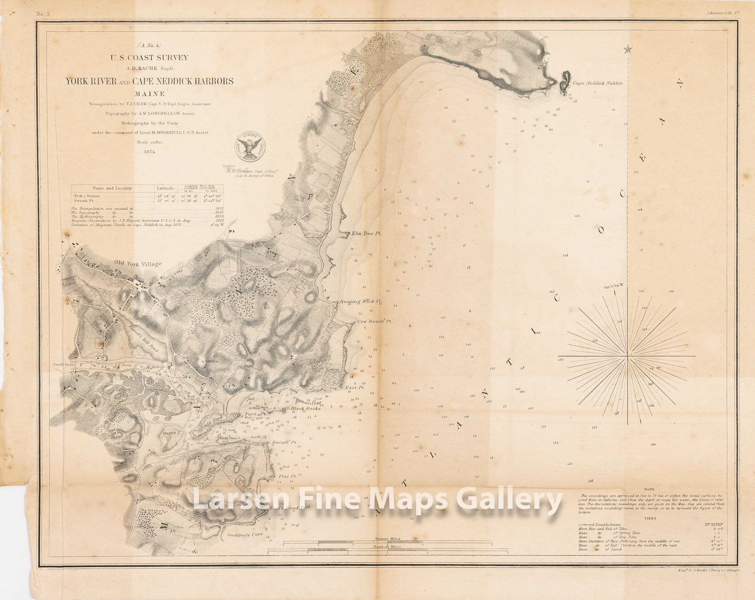
A No. 4 York River and Cape Neddick Harbors Maine
DESCRIPTION
Chart of York River from Godfrey's Cove to Cape Neddick showing a great deal of inland detail including roads, rivers, creeks, farms, buildings, vegetation, topography (hachures) etc. Many points and locations are noted including; SewallÕs Bridge, (The original bridge was built in 1761) Old York Village, Cape Neddick Nubble, Elm Tree Point, Roaring Rock Point, BarrettÕs Mill Pond, Sweats Point, Flat Point, Seals Head Point, GodfreyÕs Cove, Stage Neck, Cow Beach Point, and Harris Island. Several Navigational hazards are also noted, comprising of Black Rocks, MilburyÕs Ledge, and RockÕs Nose.
This variant includes the Coast Survey Office Emblem.
IMPORTANT NOTE:
All of our United States Coast Survey (USCS), United States Coast & Geodetic Survey (USC&GS), and similar maps and charts have been professionally unfolded and flattened using humidity baths, semi-permeable membrane, and drying blotter techniques. Most others you typically see on eBay have not been, and worse, are quickly and crudely unfolded for the low-quality photos you see. Unfolding these maps in that way is damaging and weakens them. Please be aware.
FULL TITLE
MAPMAKER/CARTOGRAPHER/AUTHOR
PUBLISHER
PUBLICATION
DIMENSIONS (Inches)
CONDITION
Choose options
DESCRIPTION
FULL TITLE
MAPMAKER/CARTOGRAPHER/AUTHOR
PUBLISHER
PUBLICATION
DIMENSIONS (Inches)
CONDITION
DESCRIPTION
FULL TITLE
MAPMAKER/CARTOGRAPHER/AUTHOR
PUBLISHER
PUBLICATION
DIMENSIONS (Inches)
CONDITION