YEAR PUBLISHED: 1854
Preliminary Chart of Portland Harbor Maine
DESCRIPTION
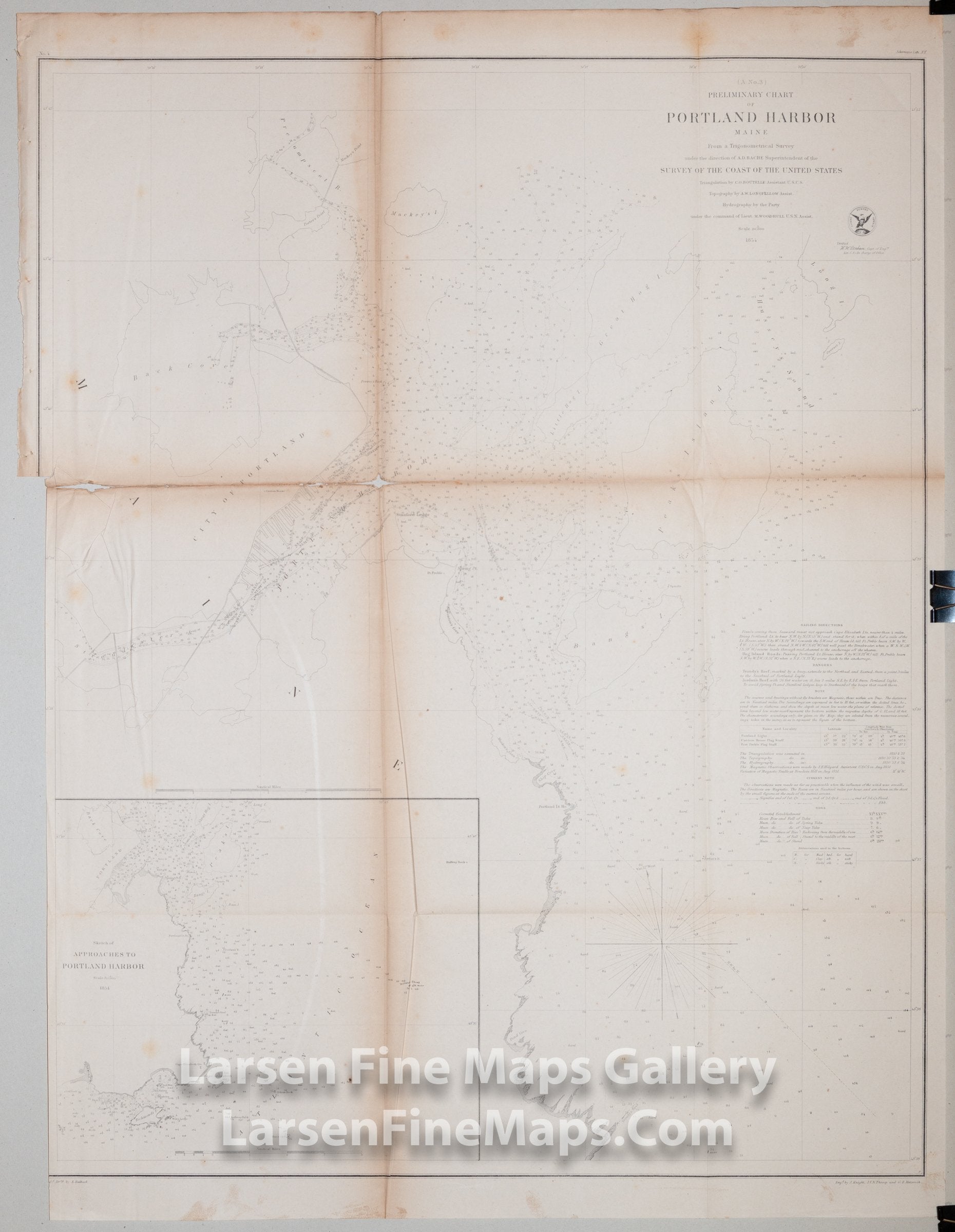
Chart of Portland Harbor, Maine focusing on the surrounding islands and waterways and approaches. This chart has great bathymetric detail in the form of numerous depth soundings, shading, notations, bottom conditions, etc. Many ranges and bearings are given along with sailing directions, tidal notes, dangers, and other information for the mariner. The many piers of the city are shown as well. An inset map showing the approaches including offshore shoals and rocks is included.
IMPORTANT NOTE:
All of our United States Coast Survey (USCS), United States Coast & Geodetic Survey (USC&GS), and similar maps and charts have been professionally unfolded and flattened using humidity baths, semi-permeable membrane, and drying blotter techniques. Most others you typically see on eBay have not been, and worse, are quickly and crudely unfolded for the low-quality photos you see. Unfolding these maps in that way is damaging and weakens them. Please be aware.
FULL TITLE
MAPMAKER/CARTOGRAPHER/AUTHOR
PUBLISHER
PUBLICATION
DIMENSIONS (Inches)
CONDITION
Choose options
DESCRIPTION
FULL TITLE
MAPMAKER/CARTOGRAPHER/AUTHOR
PUBLISHER
PUBLICATION
DIMENSIONS (Inches)
CONDITION
DESCRIPTION
FULL TITLE
MAPMAKER/CARTOGRAPHER/AUTHOR
PUBLISHER
PUBLICATION
DIMENSIONS (Inches)
CONDITION