YEAR PUBLISHED: 1855
Long Island Sound (Western Sheet)
DESCRIPTION
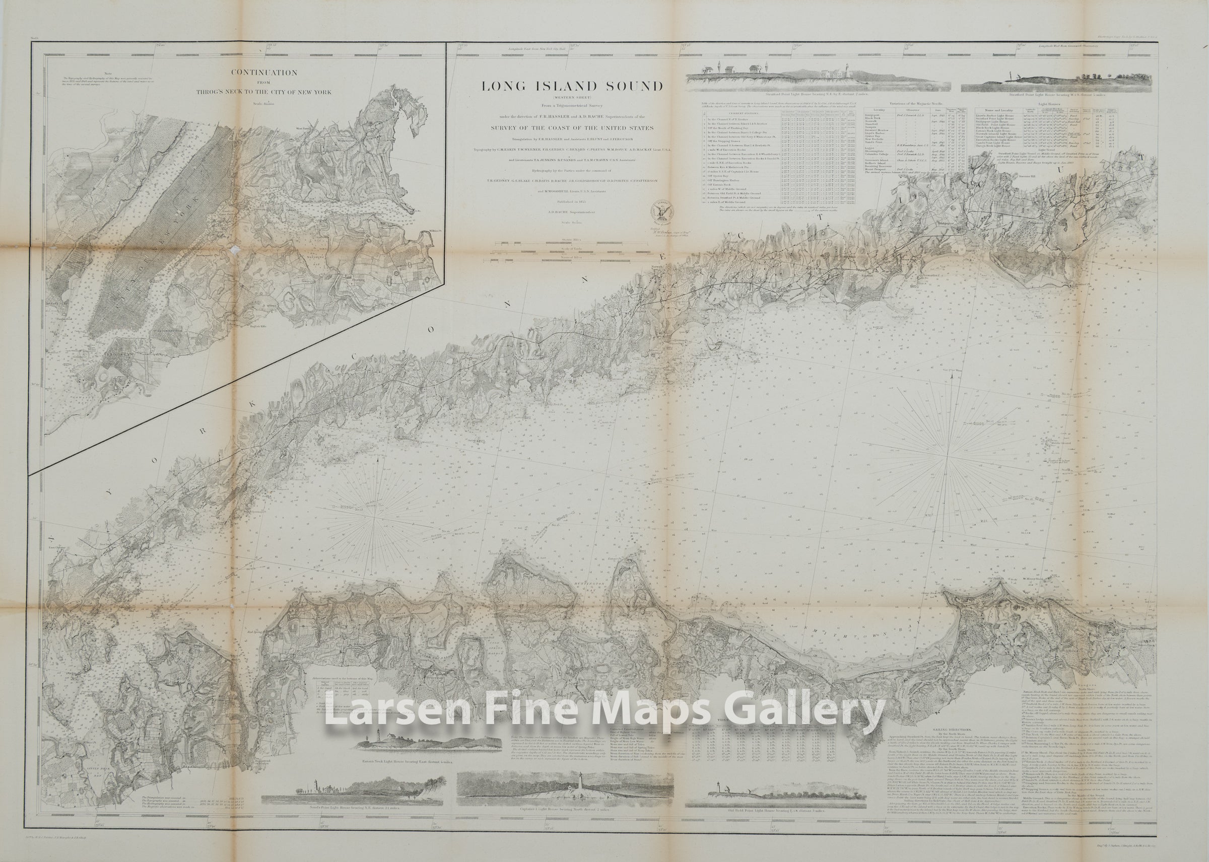
Very detailed chart of the Western Part of Long Island Sound. Chart shows great details from New York to just beyond Mount Misery Point and Stratford, Connecticut. The chart series shows superb inland detail including roads, properties, buildings, ponds, lagoons, topography (hachures), rivers, creeks, vegetation, towns, cities, railroads and locations. Great navigational details are also given in the sound with numerous depth soundings, bottom conditions, tidal currents, channels, ranges, bearings, lighthouses, aids and hazards to mariners, detailed sailing directions, dangers and other notes to the mariner. Also included are 3 nice elevation views of various stretches of coastline. Part 1 of a 3 maps set. Engraved by S. Siebert, A. Rolle, J. Knight, W. Smith.
IMPORTANT NOTE:
All of our United States Coast Survey (USCS), United States Coast & Geodetic Survey (USC&GS), and similar maps and charts have been professionally unfolded and flattened using humidity baths, semi-permeable membrane, and drying blotter techniques. Most others you typically see on eBay have not been, and worse, are quickly and crudely unfolded for the low-quality photos you see. Unfolding these maps in that way is damaging and weakens them. Please be aware.
FULL TITLE
MAPMAKER/CARTOGRAPHER/AUTHOR
PUBLISHER
PUBLICATION
DIMENSIONS (Inches)
CONDITION
Choose options
DESCRIPTION
FULL TITLE
MAPMAKER/CARTOGRAPHER/AUTHOR
PUBLISHER
PUBLICATION
DIMENSIONS (Inches)
CONDITION
DESCRIPTION
FULL TITLE
MAPMAKER/CARTOGRAPHER/AUTHOR
PUBLISHER
PUBLICATION
DIMENSIONS (Inches)
CONDITION