YEAR PUBLISHED: 1850
Reconnaissance of Hatteras Inlet Harbor of Refuge Coast of North Carolina
DESCRIPTION
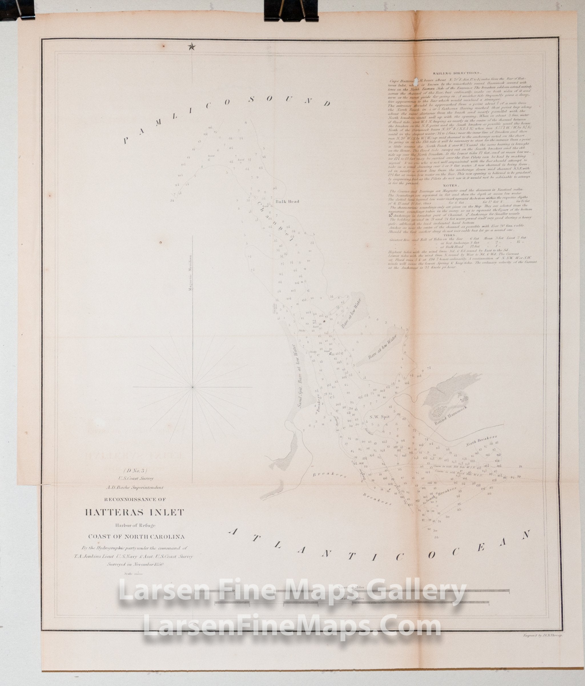
Chart of Hatteras Inlet to Pamlico Sound, North Carolina. Ranges is given to a point on Round Hammock. Extensive depth soundings, bathymetry, bars, ranges, channels, aids, and hazards to navigation are shown. Sailing directions and tidal notes are also given.
From Powell's Gazetteer (1968): "Hatteras Inlet, an inlet from the Atlantic Ocean into Pamlico Sound, lies between Hatteras Island, south Dare County, on the north, and Ocracoke Island, south Hyde County, on the south. It was opened in 1846. Previously was closer to Ocracoke Inlet and closed in 1760-70. From 1760-70 to 1846, Cape Hatteras was joined to Ocracoke Island."
IMPORTANT NOTE:
All of our United States Coast Survey (USCS), United States Coast & Geodetic Survey (USC&GS), and similar maps and charts have been professionally unfolded and flattened using humidity baths, semi-permeable membrane, and drying blotter techniques. Most others you typically see on eBay have not been, and worse, are quickly and crudely unfolded for the low-quality photos you see. Unfolding these maps in that way is damaging and weakens them. Please be aware.
FULL TITLE
MAPMAKER/CARTOGRAPHER/AUTHOR
PUBLISHER
PUBLICATION
DIMENSIONS (Inches)
CONDITION
Choose options
DESCRIPTION
FULL TITLE
MAPMAKER/CARTOGRAPHER/AUTHOR
PUBLISHER
PUBLICATION
DIMENSIONS (Inches)
CONDITION
DESCRIPTION
FULL TITLE
MAPMAKER/CARTOGRAPHER/AUTHOR
PUBLISHER
PUBLICATION
DIMENSIONS (Inches)
CONDITION