YEAR PUBLISHED: 1930
Santa Barbara CAL.
DESCRIPTION
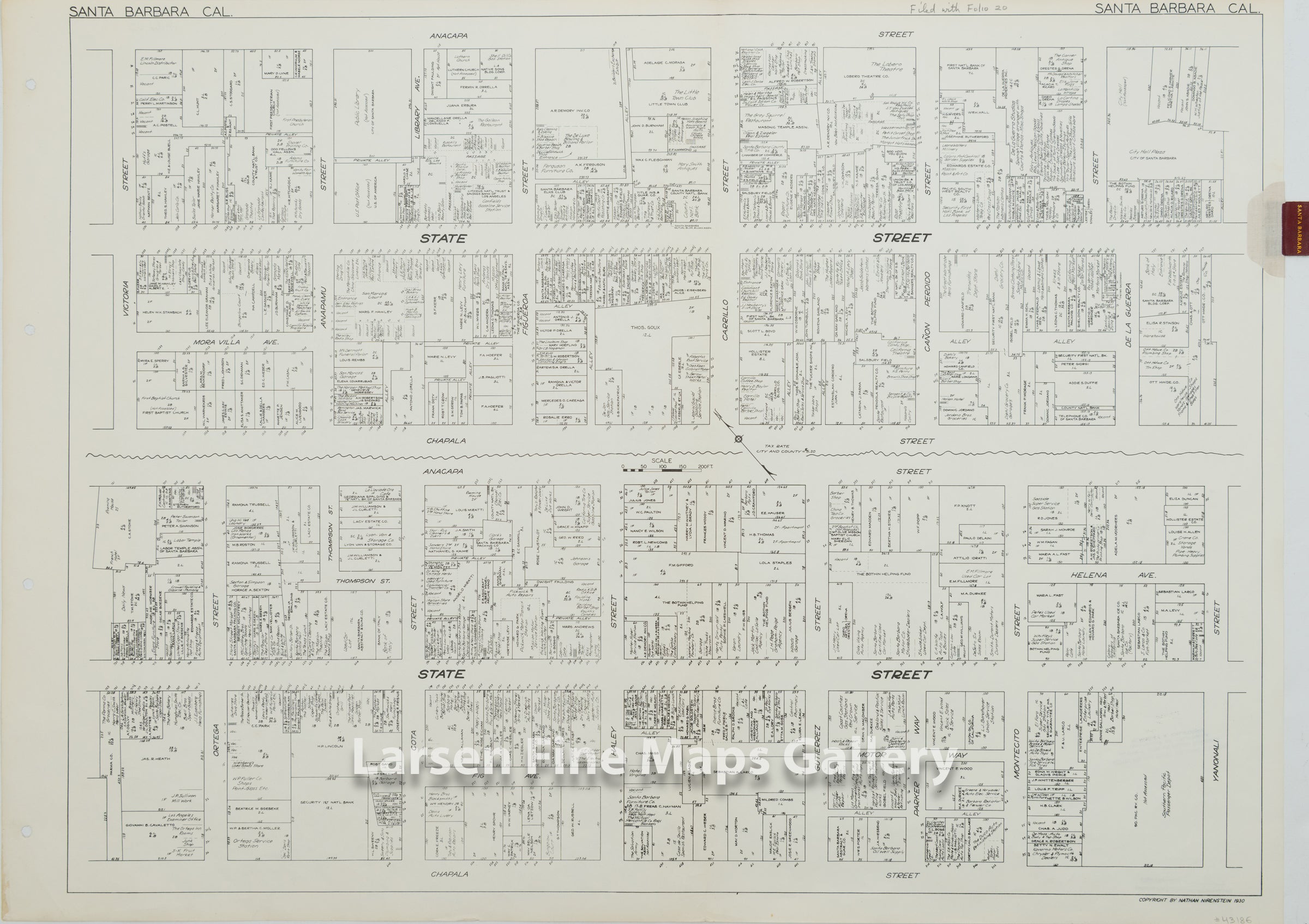
A very interesting and highly detailed map of the State Street business corridor of Santa Barbara. The map divides State Street into two sections on the map separated by a wavy line. The north section shows the properties and businesses from Victoria Street to De La Guerra Street, the south section continues down to Yanonali Street.
FULL TITLE
MAPMAKER/CARTOGRAPHER/AUTHOR
PUBLISHER
PUBLICATION
DIMENSIONS (Inches)
CONDITION
Choose options
DESCRIPTION
FULL TITLE
MAPMAKER/CARTOGRAPHER/AUTHOR
PUBLISHER
PUBLICATION
DIMENSIONS (Inches)
CONDITION
DESCRIPTION
FULL TITLE
MAPMAKER/CARTOGRAPHER/AUTHOR
PUBLISHER
PUBLICATION
DIMENSIONS (Inches)
CONDITION