YEAR PUBLISHED: 1859
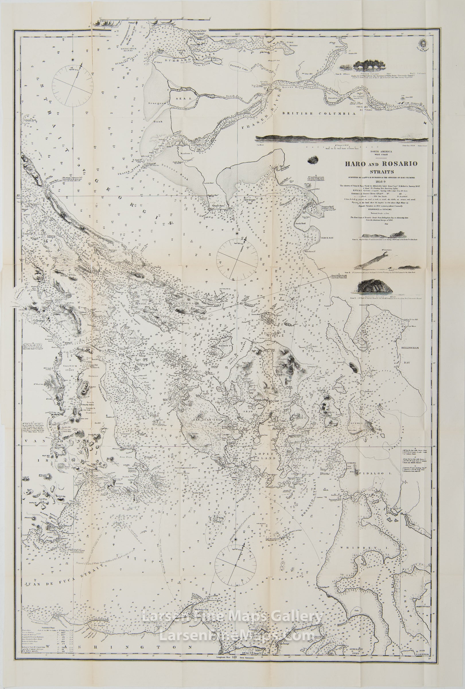
North America - West Coast, Haro and Rosario Straits Surveyed by Captn. G.H. Richards & The Officers of H.M.S. Plumper 1858-9
DESCRIPTION
A very nice map of the Pacific Northwest in the area of Vancouver Island, San Juan Islands, and the Strait of Juan de Fuca. Depths shown by soundings. Relief shown by hachures. "Soundings in fathoms." Shows detailed topography and bathymetry of the Straits of Juan de Fuca and waters between Straits of Georgia and Admiralty Inlet. Identifies islands, coastal features, reefs. currents, and mountain peaks. Also shows some elevation views.
NOTE: This is not the original 1859 chart done by Captain G. H. Richards, this is a copy that was made by the British Admiralty circa 1872, from my understanding, for the U.S. Congress.
IMPORTANT NOTE:
All of our United States Coast Survey (USCS), United States Coast & Geodetic Survey (USC&GS), and similar maps and charts have been professionally unfolded and flattened using humidity baths, semi-permeable membrane, and drying blotter techniques. Most others you typically see on eBay have not been, and worse, are quickly and crudely unfolded for the low-quality photos you see. Unfolding these maps in that way is damaging and weakens them. Please be aware.
FULL TITLE
MAPMAKER/CARTOGRAPHER/AUTHOR
PUBLISHER
PUBLICATION
DIMENSIONS (Inches)
CONDITION
Choose options
DESCRIPTION
FULL TITLE
MAPMAKER/CARTOGRAPHER/AUTHOR
PUBLISHER
PUBLICATION
DIMENSIONS (Inches)
CONDITION
DESCRIPTION
FULL TITLE
MAPMAKER/CARTOGRAPHER/AUTHOR
PUBLISHER
PUBLICATION
DIMENSIONS (Inches)
CONDITION