YEAR PUBLISHED: 1861
Preliminary Chart of Mount Hope Bay, Rhode Island
DESCRIPTION
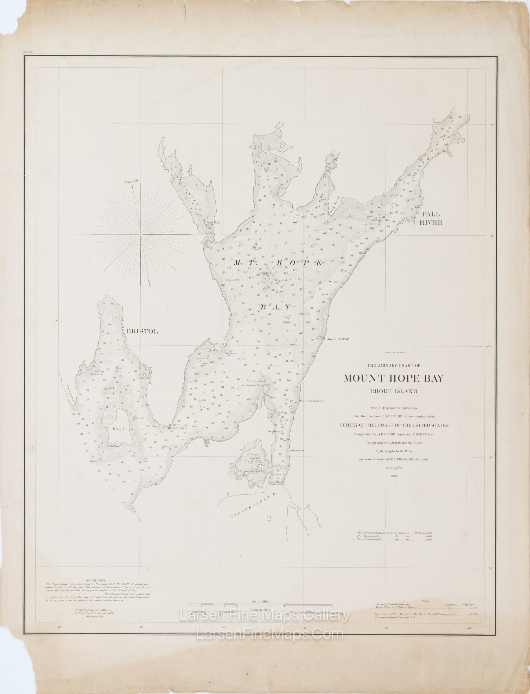
A thick-paper separately issued chart of Mount Hope Bay, Rhode Island. The chart shows sounding, bottom materials, aids to navigation, points, islands, miscellaneous features, and places—bathymetry shown by stipple patterns/shading and soundings. Rare, separately issued heavy paper, thick paper edition.
FULL TITLE
MAPMAKER/CARTOGRAPHER/AUTHOR
PUBLISHER
PUBLICATION
DIMENSIONS (Inches)
CONDITION
Choose options
DESCRIPTION
FULL TITLE
MAPMAKER/CARTOGRAPHER/AUTHOR
PUBLISHER
PUBLICATION
DIMENSIONS (Inches)
CONDITION
DESCRIPTION
FULL TITLE
MAPMAKER/CARTOGRAPHER/AUTHOR
PUBLISHER
PUBLICATION
DIMENSIONS (Inches)
CONDITION