YEAR PUBLISHED: 1853
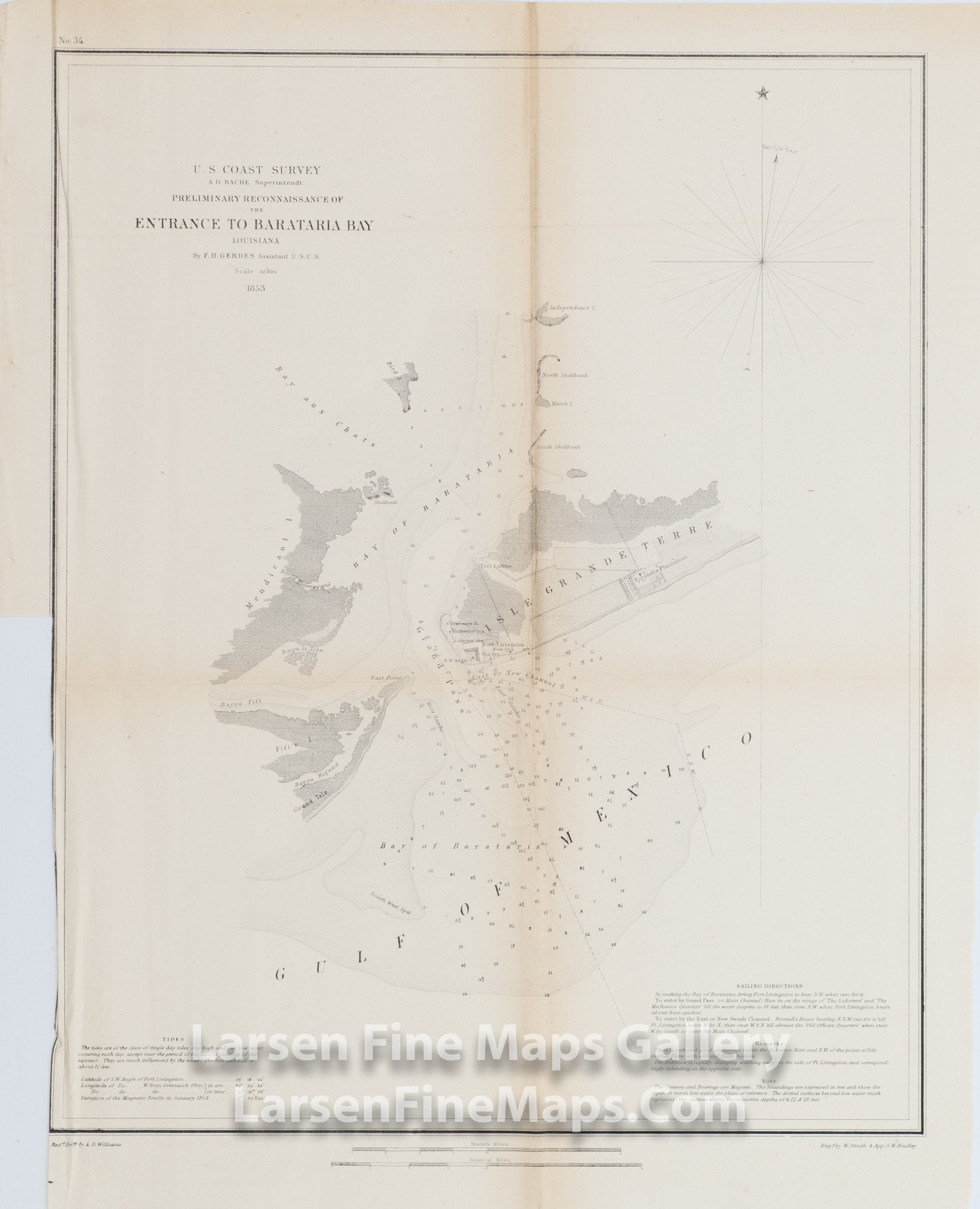
Preliminary Reconnaissance of the Entrance to Barataria Bay Louisiana
DESCRIPTION
Chart of the Entrance to Barataria Bay, Louisiana. Details the "Grand Pass" and other channels and entrance into the Bay of Barataria and Bay aux Chats between East Point of Grand Isle, Fifi's Isle, Mendicant Island and Fort Livingston on Isle Grande Terre. Forstall's Plantation, details of Fort Livingston, Fort Lafitte, and vegetations are shown. Extends northward to Independence Island and Bird Island. Sailing directions, tidal notes, and remarks are also given.
FULL TITLE
MAPMAKER/CARTOGRAPHER/AUTHOR
PUBLISHER
PUBLICATION
DIMENSIONS (Inches)
CONDITION
Choose options
DESCRIPTION
FULL TITLE
MAPMAKER/CARTOGRAPHER/AUTHOR
PUBLISHER
PUBLICATION
DIMENSIONS (Inches)
CONDITION
DESCRIPTION
FULL TITLE
MAPMAKER/CARTOGRAPHER/AUTHOR
PUBLISHER
PUBLICATION
DIMENSIONS (Inches)
CONDITION