YEAR PUBLISHED: 1917
Ma'an, Ottoman Empire
DESCRIPTION
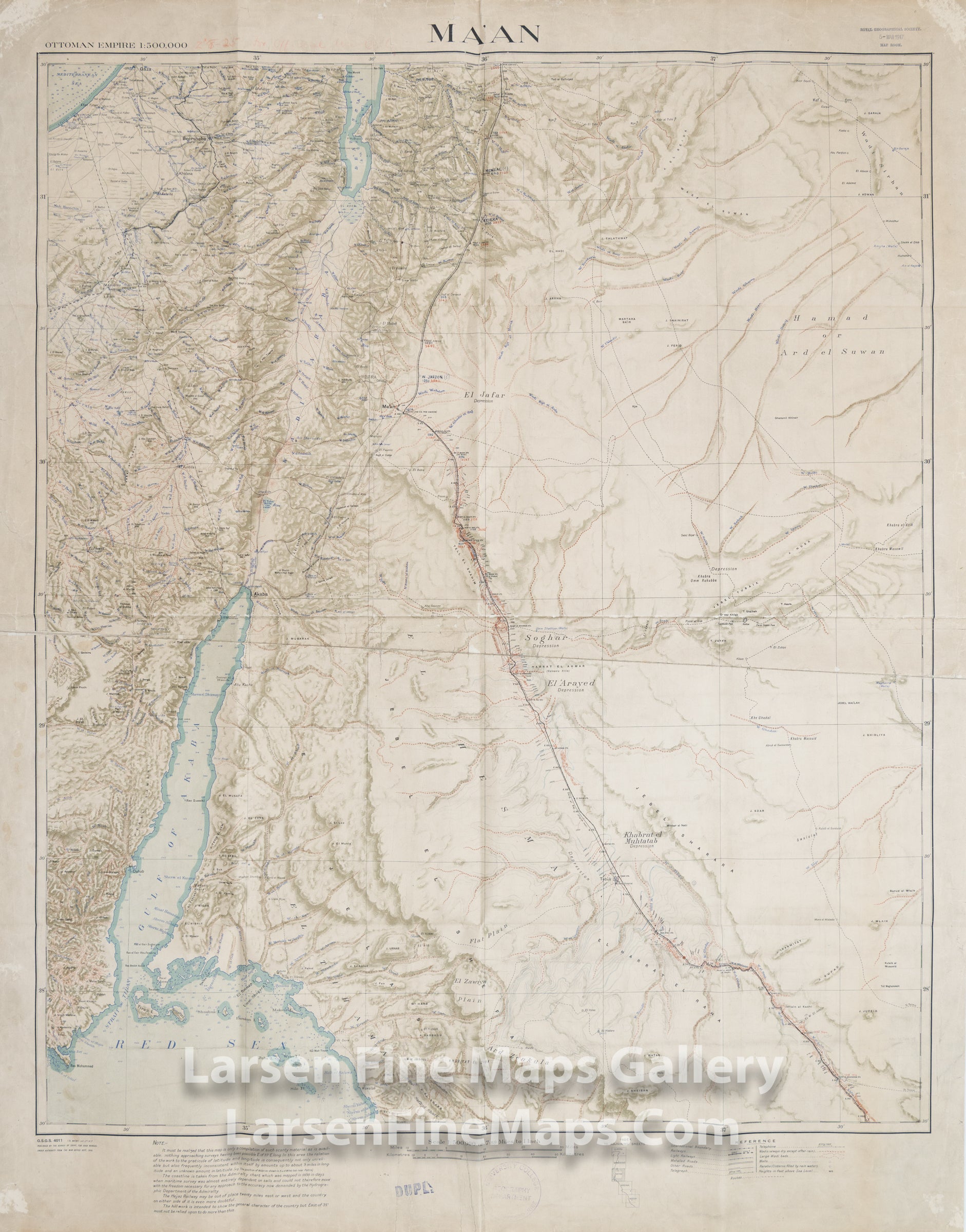
An interesting War Office map of Ma'an, covering Jordan, published by the Survey of Egypt, 1917. The map shows the region at the terminus of the Red Sea and the Gulf of Akaba. What makes this map interesting is the lengthy disclaimer describing how unreliable and inconsistent this map is with regards to cartographic and graticule accuracies and the poor accuracy of the mapped coastline due to the 1850 vintage charts used as base data. The disclaimer goes on to state; "The Hejaz Railway may be out of place twenty miles east or west and the country on either side of it is even more doubtful." Hachures show relief.
FULL TITLE
MAPMAKER/CARTOGRAPHER/AUTHOR
PUBLISHER
PUBLICATION
DIMENSIONS (Inches)
CONDITION
Choose options
DESCRIPTION
FULL TITLE
MAPMAKER/CARTOGRAPHER/AUTHOR
PUBLISHER
PUBLICATION
DIMENSIONS (Inches)
CONDITION
DESCRIPTION
FULL TITLE
MAPMAKER/CARTOGRAPHER/AUTHOR
PUBLISHER
PUBLICATION
DIMENSIONS (Inches)
CONDITION