YEAR PUBLISHED: 1851
United States
DESCRIPTION
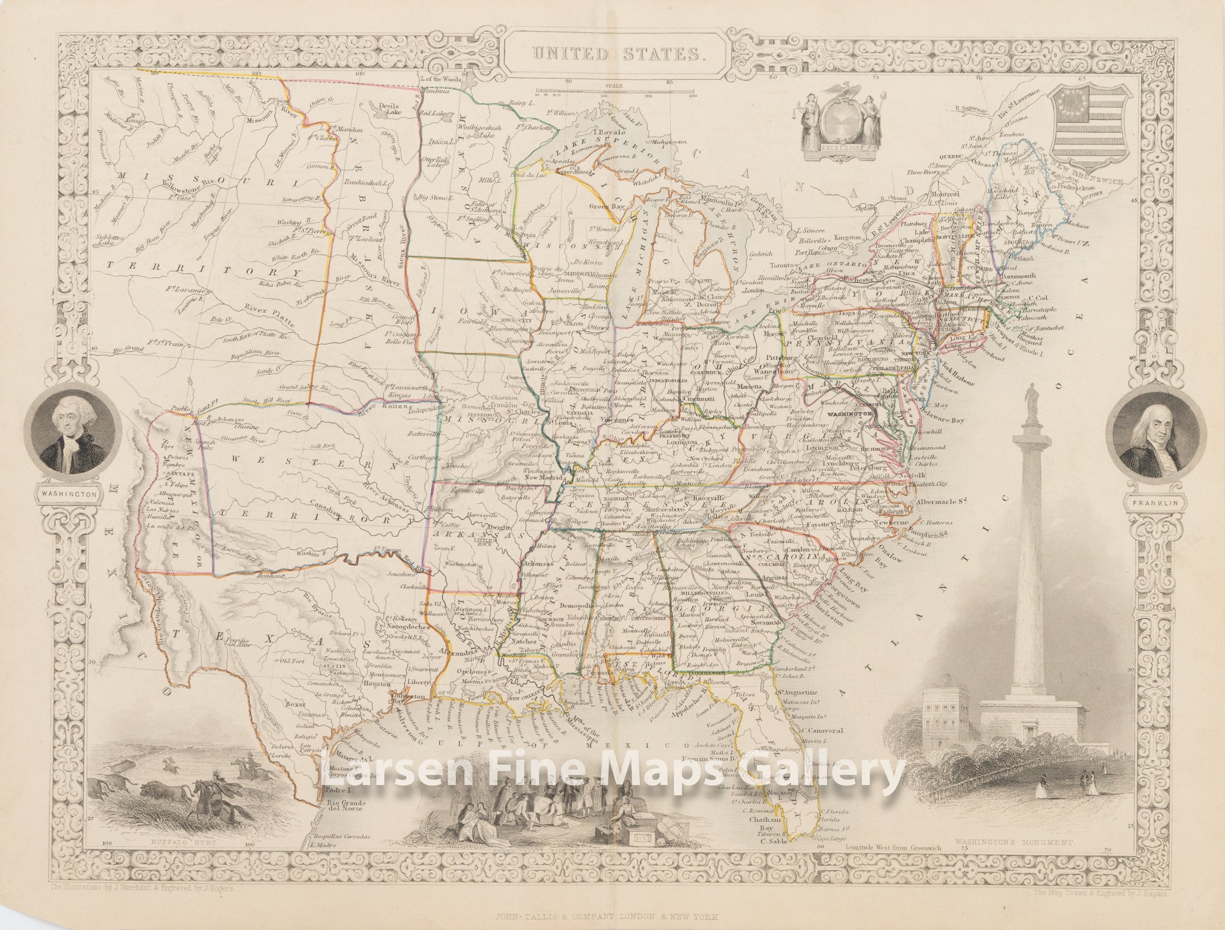
A striking map of the United States as it was depicted by John Tallis in 1851. Texas was recently added to the Union with borders still unsettled. The western portion of the map shows many interesting borders and areas, including an elongated Nebraska from the Kanzas River to the Canadian border, a "Western Territory" north of Texas and east of New Mexico, New Mexico being a very preliminary configuration and labeled as "New Mexico or Santa Fe" and is ended at the Rio Grande del North, with Mexico to the west and the Missouri Territory to the north albeit without a border separating it from Mexico.
Vignettes of a Buffalo Hunt, Penn's Treaty with the Indians, Washington's Monument, and portraits of Franklin and Washington adorn the border on left and right.
FULL TITLE
MAPMAKER/CARTOGRAPHER/AUTHOR
PUBLISHER
PUBLICATION
DIMENSIONS (Inches)
CONDITION
Choose options
DESCRIPTION
FULL TITLE
MAPMAKER/CARTOGRAPHER/AUTHOR
PUBLISHER
PUBLICATION
DIMENSIONS (Inches)
CONDITION
DESCRIPTION
FULL TITLE
MAPMAKER/CARTOGRAPHER/AUTHOR
PUBLISHER
PUBLICATION
DIMENSIONS (Inches)
CONDITION