
YEAR PUBLISHED: 1840
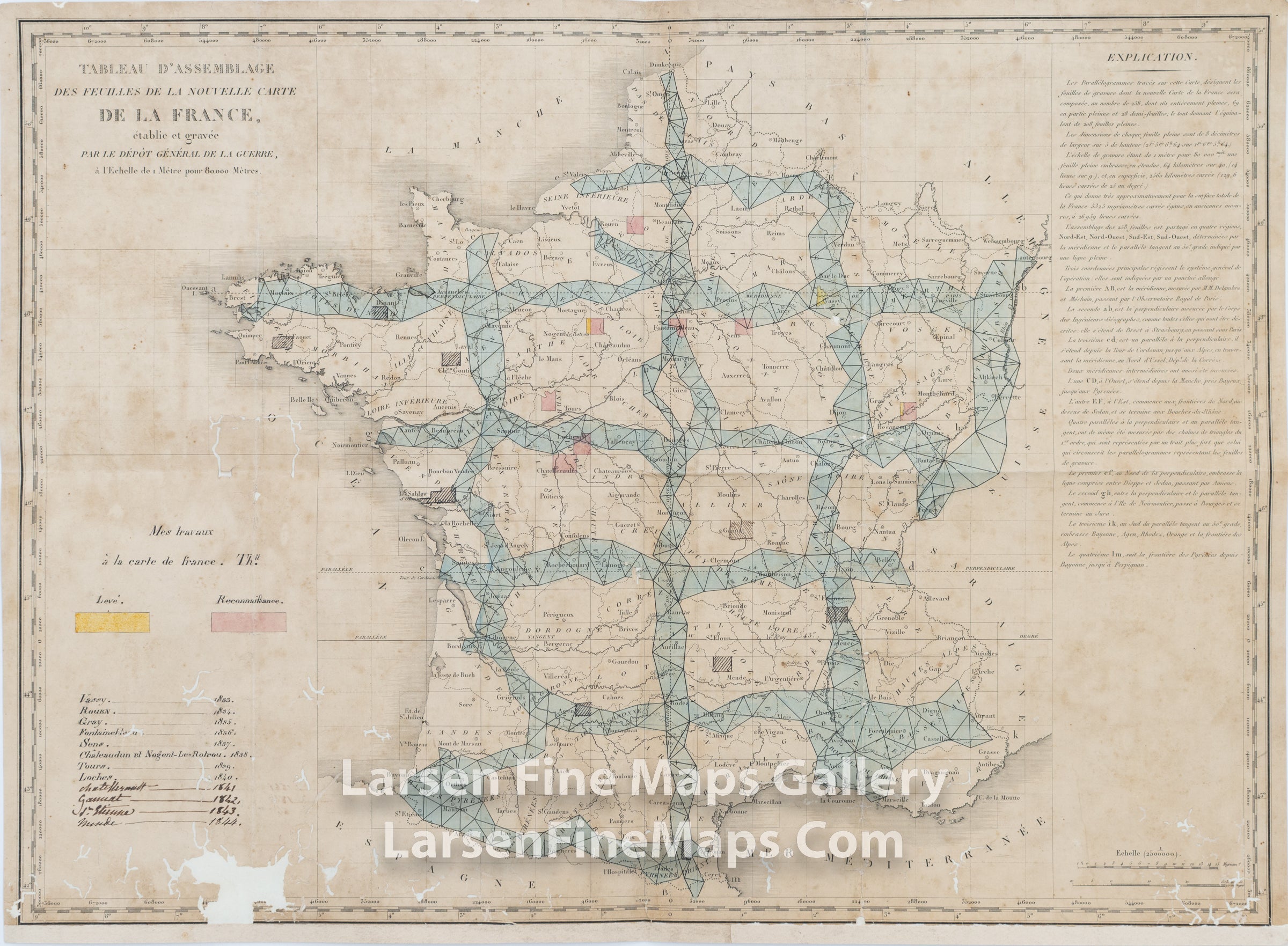
Tableau D'Assemblage des feuilles de la nouvelle Carte de la France, etableie et gravee par le Depot General de la Guerre
DESCRIPTION
This map shows the triangulation mapping for France's meridians and baselines (perpendiculars). The map also shows the proposed tiles/sheets as faintly outlined rectangles covering France (258 sheets). This index map appears to be a working document of an unknown cartographer, as deduced by the title "My Work on the Map of France". The Department of War or Dépôt de la Guerre funded the mapping project to replace Cassini's seminal map of France as instructed by Napoleon in 1808. The map is mounted to archival backing, as acquired. We are unable to locate other examples online. It is a very unique map.
Translated Title:
Assembly table of the sheets of the new map of France, established and engraved by the General War Department, on a scale of 1 meter for 80,000 meters.
FULL TITLE
MAPMAKER/CARTOGRAPHER/AUTHOR
PUBLISHER
PUBLICATION
DIMENSIONS (Inches)
CONDITION
Choose options

DESCRIPTION
FULL TITLE
MAPMAKER/CARTOGRAPHER/AUTHOR
PUBLISHER
PUBLICATION
DIMENSIONS (Inches)
CONDITION
DESCRIPTION
FULL TITLE
MAPMAKER/CARTOGRAPHER/AUTHOR
PUBLISHER
PUBLICATION
DIMENSIONS (Inches)
CONDITION