YEAR PUBLISHED: 1859
Hempstead Harbor Long Island
DESCRIPTION
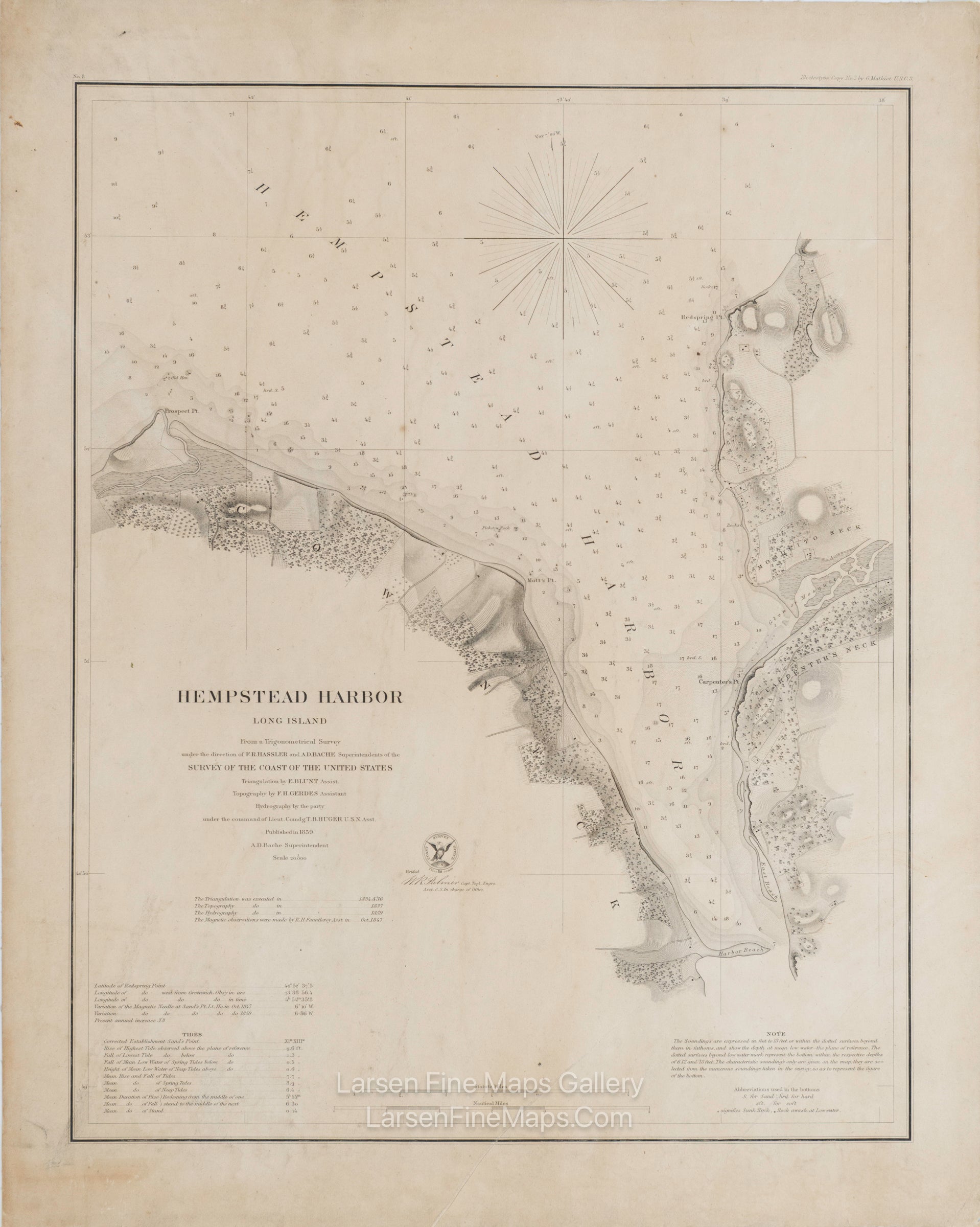
A very nice detailed chart of Hempstead Harbor, New York. This is a separately issued thick paper edition with linen backing. This chart shows great inland details of topography by hachures, vegetation, farmlands, roads, buildings, facilities, and place names. Some aids to navigation are also shown, such as depth soundings, anchorages, rocks, and points. Notes, tides, and abbreviations of bottom conditions are also shown.
FULL TITLE
MAPMAKER/CARTOGRAPHER/AUTHOR
PUBLISHER
PUBLICATION
DIMENSIONS (Inches)
CONDITION
Choose options
DESCRIPTION
FULL TITLE
MAPMAKER/CARTOGRAPHER/AUTHOR
PUBLISHER
PUBLICATION
DIMENSIONS (Inches)
CONDITION
DESCRIPTION
FULL TITLE
MAPMAKER/CARTOGRAPHER/AUTHOR
PUBLISHER
PUBLICATION
DIMENSIONS (Inches)
CONDITION