YEAR PUBLISHED: 1888
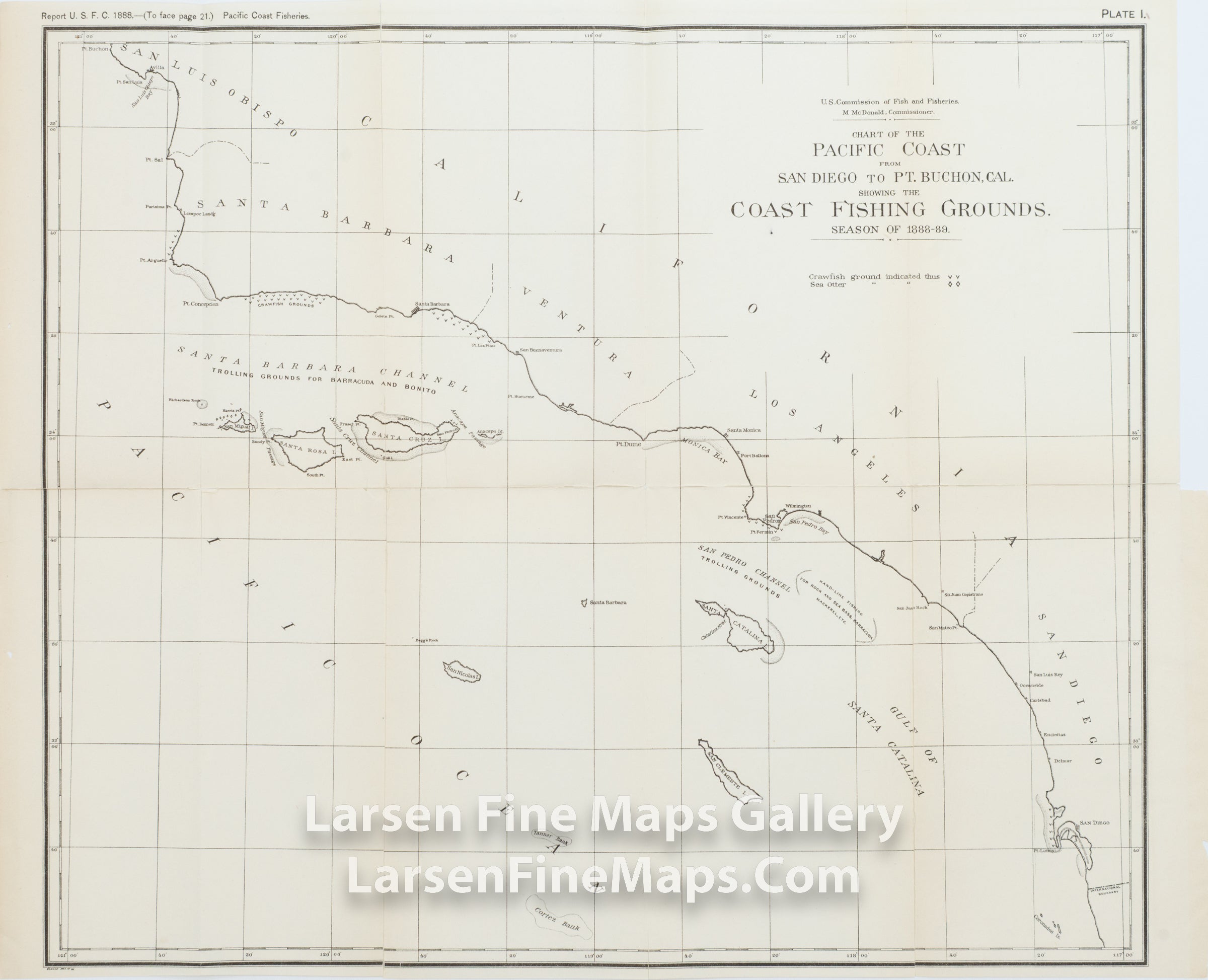
Chart of the Pacific Coast from San Diego to Pt. Buchon, Cal. Showing the Coast Fishing Grounds Season of 1888-89
DESCRIPTION
Chart of the Pacific Coast from San Diego to Pt. Buchon, Cal. Showing the Coast Fishing Grounds Season of 1888-89. A very interesting map showing the trolling grounds, lobster (crawfish) grounds, islands, banks, and species of fish to catch.
IMPORTANT NOTE:
All of our United States Coast Survey (USCS), United States Coast & Geodetic Survey (USC&GS), and similar maps and charts have been professionally unfolded and flattened using humidity baths, semi-permeable membrane, and drying blotter techniques. Most others you typically see on eBay have not been, and worse, are quickly and crudely unfolded for the low-quality photos you see. Unfolding these maps in that way is damaging and weakens them. Please be aware.
FULL TITLE
MAPMAKER/CARTOGRAPHER/AUTHOR
PUBLISHER
PUBLICATION
DIMENSIONS (Inches)
CONDITION
Choose options
DESCRIPTION
FULL TITLE
MAPMAKER/CARTOGRAPHER/AUTHOR
PUBLISHER
PUBLICATION
DIMENSIONS (Inches)
CONDITION
DESCRIPTION
FULL TITLE
MAPMAKER/CARTOGRAPHER/AUTHOR
PUBLISHER
PUBLICATION
DIMENSIONS (Inches)
CONDITION