YEAR PUBLISHED: 1762
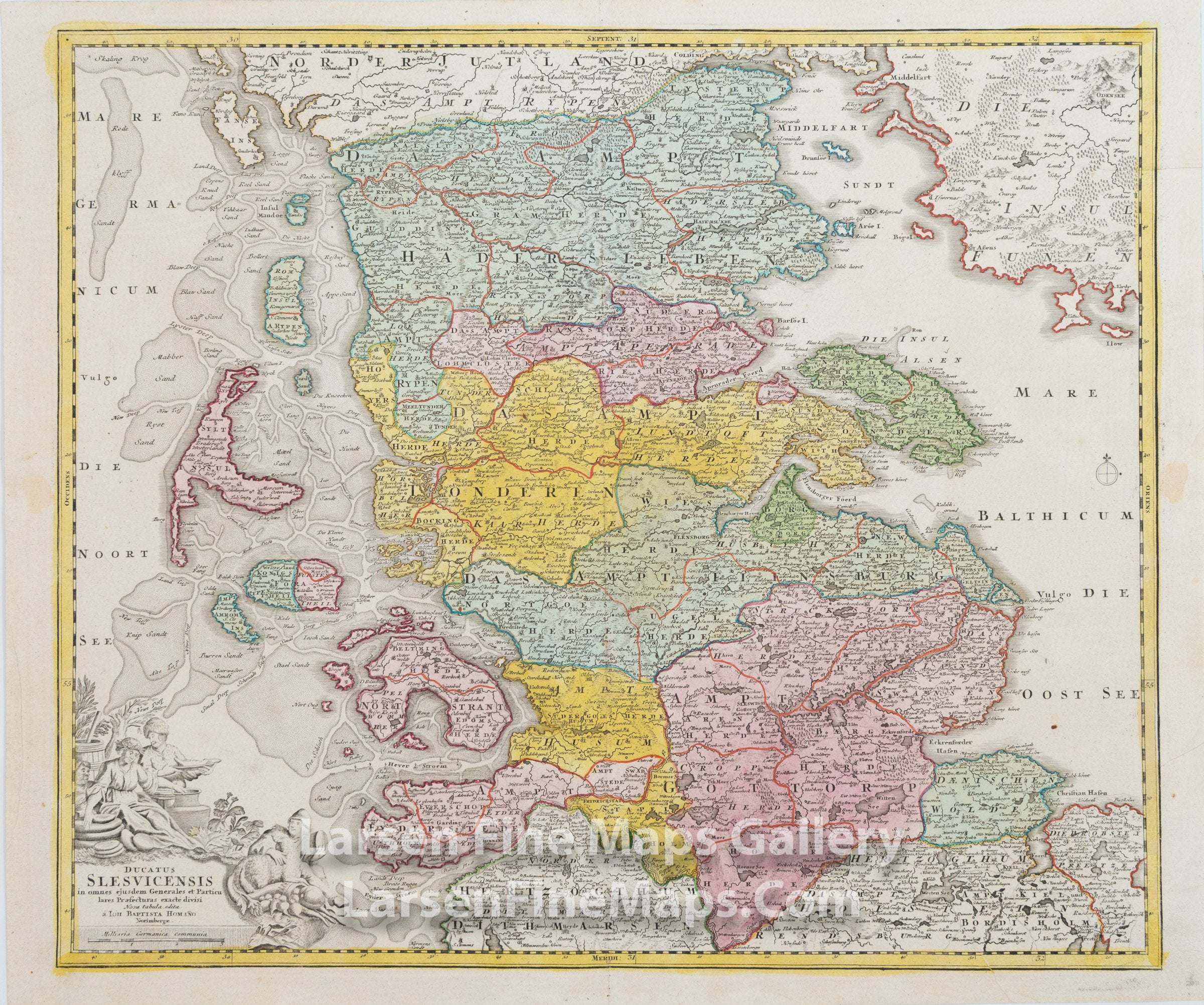
Ducatus Slesvicensis in omnes eiusdem Generales et Particulares Praefecturas exacte divisi Nova tabula edita
DESCRIPTION
This is a beautiful and striking example of Homann's map of Germany's northernmost state (Schleswig-Holstein) and nearby islands. The map is beautifully hand-colored in outline and wash as published. The map shows the cities Sonderborg, Humus, Flensburg, and Schleswig along with relief shown pictorially, ports and towns, waterways and bodies, churches, forests, along with a highly decorative cartouche in the lower left.
FULL TITLE
MAPMAKER/CARTOGRAPHER/AUTHOR
PUBLISHER
PUBLICATION
DIMENSIONS (Inches)
CONDITION
Choose options
DESCRIPTION
FULL TITLE
MAPMAKER/CARTOGRAPHER/AUTHOR
PUBLISHER
PUBLICATION
DIMENSIONS (Inches)
CONDITION
DESCRIPTION
FULL TITLE
MAPMAKER/CARTOGRAPHER/AUTHOR
PUBLISHER
PUBLICATION
DIMENSIONS (Inches)
CONDITION