YEAR PUBLISHED: 1762
Circulus Saxoniae Inferioris in omnes suos Status et Principatus
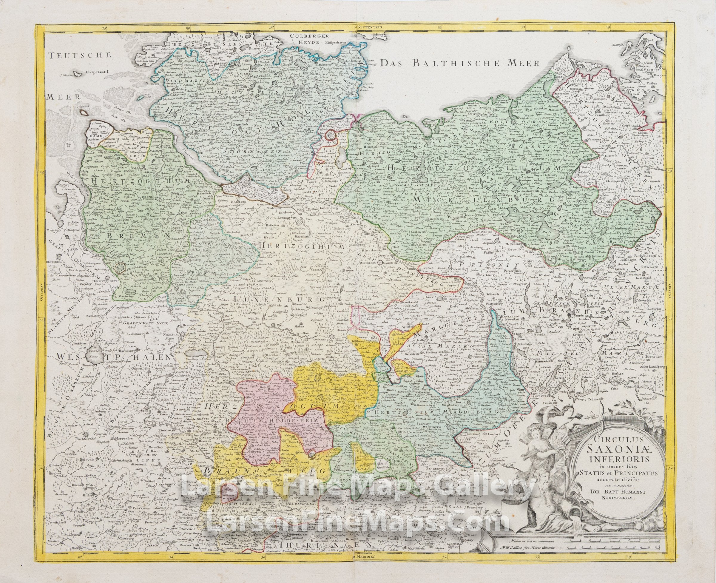
DESCRIPTION
This is a beautiful and striking example of Homann's map of the northern portion of Germany. The map is beautifully hand-colored in outline and wash as published. The map shows relief, towns, forests, fortifications, churches, and other information pictorially, along with a decorative cartouche in the lower right.
FULL TITLE
MAPMAKER/CARTOGRAPHER/AUTHOR
PUBLISHER
PUBLICATION
DIMENSIONS (Inches)
CONDITION
Choose options
DESCRIPTION
FULL TITLE
MAPMAKER/CARTOGRAPHER/AUTHOR
PUBLISHER
PUBLICATION
DIMENSIONS (Inches)
CONDITION
DESCRIPTION
FULL TITLE
MAPMAKER/CARTOGRAPHER/AUTHOR
PUBLISHER
PUBLICATION
DIMENSIONS (Inches)
CONDITION