YEAR PUBLISHED: 1762
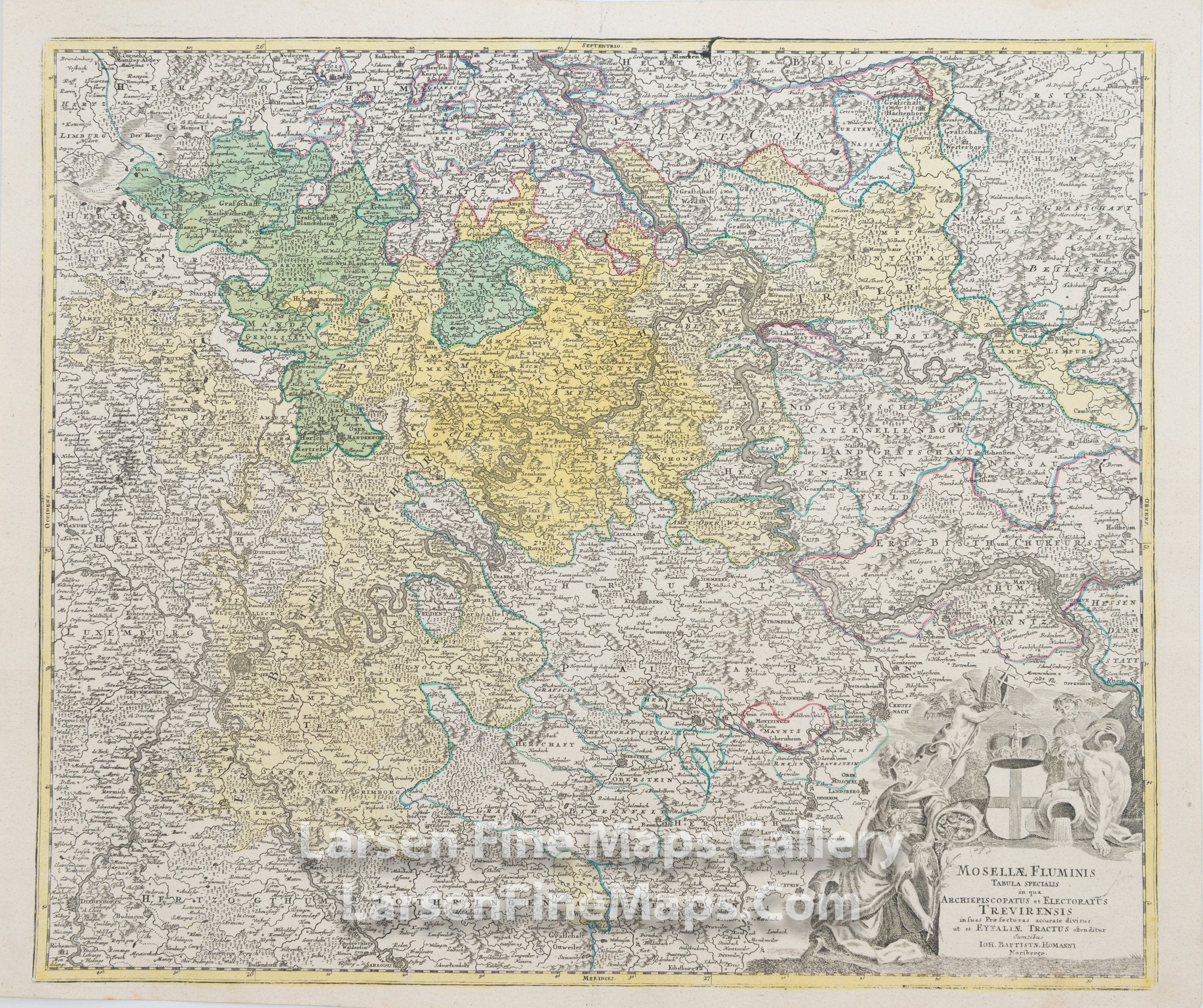
Mosellae Fluminis Tabula Specialis in qua Archiepiscopatus et Electoratus Trevirensis
DESCRIPTION
This is a beautiful and striking example of Homann's map of Rhineland-Palatinate Province. The map is beautifully hand-colored in outline and wash as published. The covered region is a southwest German state bordered by France, Belgium and Luxembourg. The map shows relief, forests, towns, fortifications, churches, and other information pictorially, along with a decorative cartouche in the lower left.
FULL TITLE
MAPMAKER/CARTOGRAPHER/AUTHOR
PUBLISHER
PUBLICATION
DIMENSIONS (Inches)
CONDITION
Choose options
DESCRIPTION
FULL TITLE
MAPMAKER/CARTOGRAPHER/AUTHOR
PUBLISHER
PUBLICATION
DIMENSIONS (Inches)
CONDITION
DESCRIPTION
FULL TITLE
MAPMAKER/CARTOGRAPHER/AUTHOR
PUBLISHER
PUBLICATION
DIMENSIONS (Inches)
CONDITION