YEAR PUBLISHED: 1747
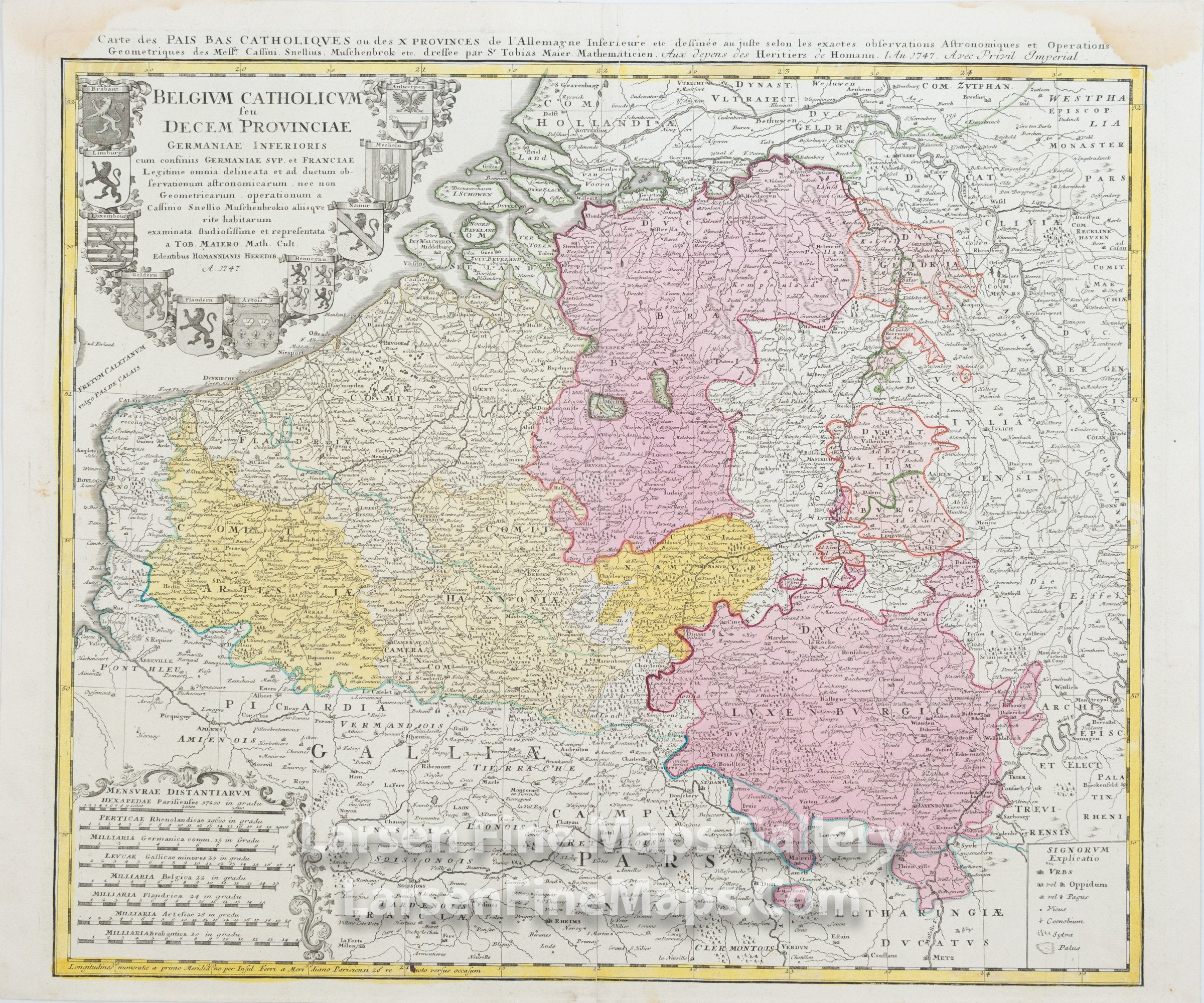
Belgium Catholicum seu Decem Provinciae Germaniae Inferioris
DESCRIPTION
This is a beautiful and striking example of Homann's map of Belgium and Luxumbourg. The map is beautifully hand-colored in outline and wash as published. The covered region extends from Luxembourg in the southeast to Valery on the coast, all of Belgium, an neighboring parts of Holland and Germany. The map shows forests, towns, fortifications, churches, and other information pictorially, along with a decorative cartouche listing ten coats of arms in the upper left and scale bars in the lower left.
FULL TITLE
MAPMAKER/CARTOGRAPHER/AUTHOR
PUBLISHER
PUBLICATION
DIMENSIONS (Inches)
CONDITION
Choose options
DESCRIPTION
FULL TITLE
MAPMAKER/CARTOGRAPHER/AUTHOR
PUBLISHER
PUBLICATION
DIMENSIONS (Inches)
CONDITION
DESCRIPTION
FULL TITLE
MAPMAKER/CARTOGRAPHER/AUTHOR
PUBLISHER
PUBLICATION
DIMENSIONS (Inches)
CONDITION