YEAR PUBLISHED: 1762
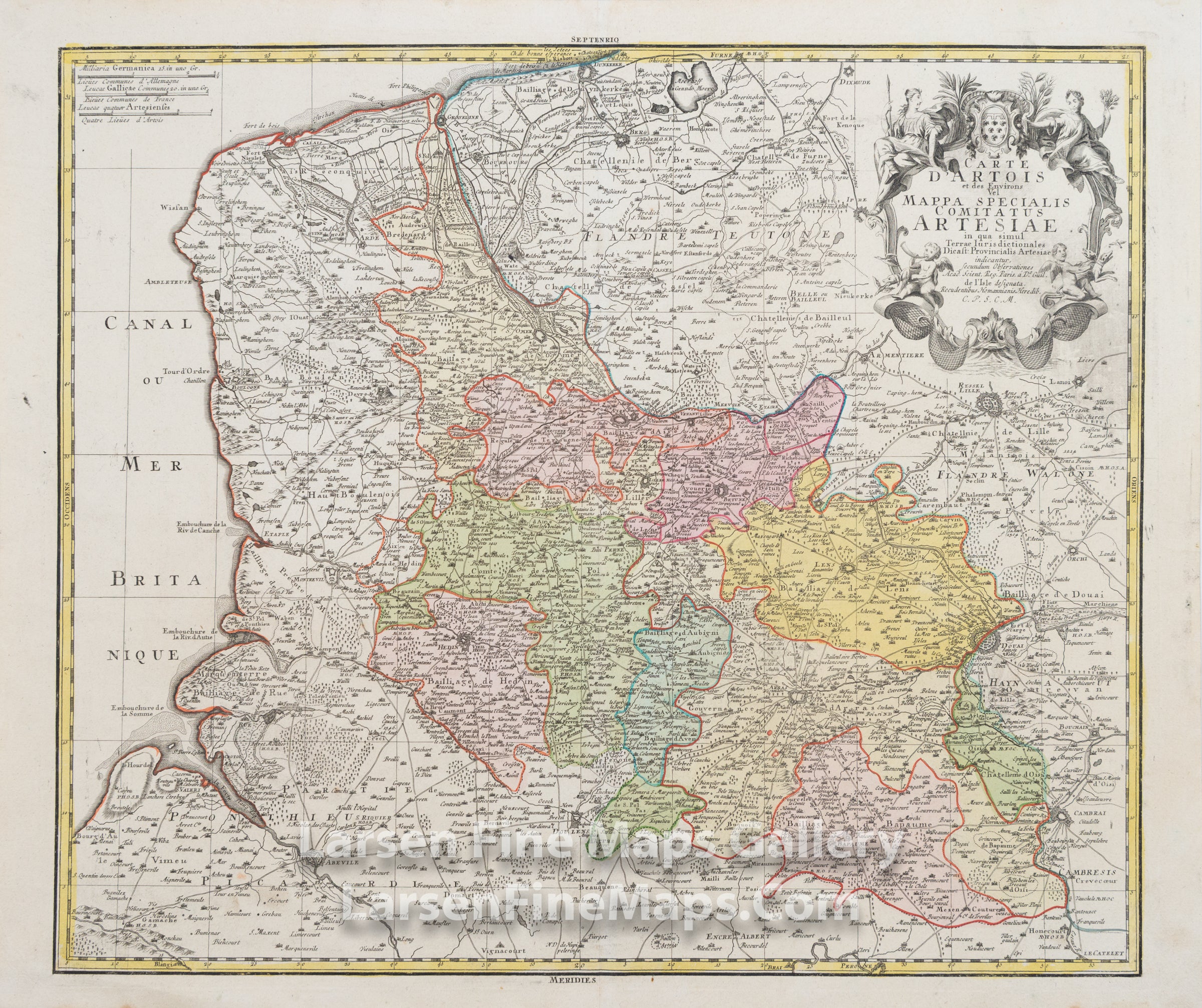
Carte d'Artois et des Environs Vel Mappa specialis Comitatus Artesiae in qua simul Terrae Iurisdictionales Dicast: Provincialis Artesiae indicantur
DESCRIPTION
This is a beautiful and striking example of Homann's map of the northernmost region of France and surrounding areas bordering Belgium. The map is beautifully hand-colored in outline and wash as published. The covered region extends from Cambria in the southeast up to Graveline in the north along the English Channel and Abevile in the southwest. The map shows relief, forests, towns, fortifications, churches, and other information pictorially, along with a decorative cartouche in the upper right and scale bars in the upper left.
FULL TITLE
MAPMAKER/CARTOGRAPHER/AUTHOR
PUBLISHER
PUBLICATION
DIMENSIONS (Inches)
CONDITION
Choose options
DESCRIPTION
FULL TITLE
MAPMAKER/CARTOGRAPHER/AUTHOR
PUBLISHER
PUBLICATION
DIMENSIONS (Inches)
CONDITION
DESCRIPTION
FULL TITLE
MAPMAKER/CARTOGRAPHER/AUTHOR
PUBLISHER
PUBLICATION
DIMENSIONS (Inches)
CONDITION