YEAR PUBLISHED: 1762
S.R.I. Circulus Rhenanus Inferior Sive Electorum Rheni complectens tres Archiepiscopatus, Moguntinum, Coloniensuem, et Treviernesem, Palatinatum Rheni
DESCRIPTION
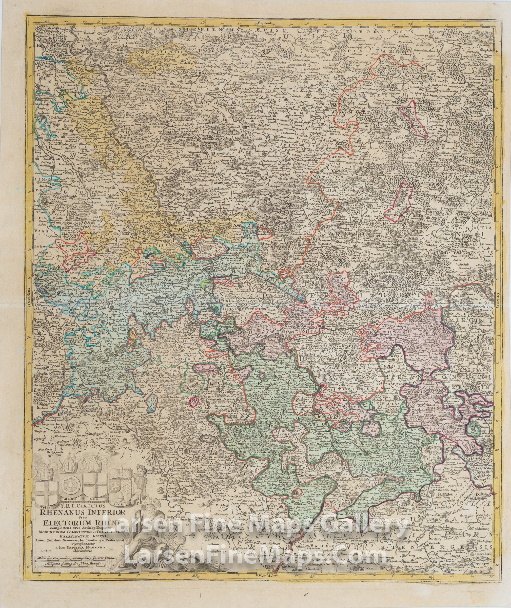
This is a striking and detailed map of the Rhine River Valley, Germany.
The map is beautifully hand-colored in outline and wash as published. This map extends from Drusenheim in the south to Wesel in the north. The map shows many place names, rivers, mountains, towns, churches, etc., pictorially as is typical of Homann's maps. A highly figurative title cartouche adorns the map, this one with the coat of arms of Trier, Maintz, Coln, and Pfaltz, along with a mileage scale.
The map is beautifully hand-colored in outline and wash as published. This map extends from Drusenheim in the south to Wesel in the north. The map shows many place names, rivers, mountains, towns, churches, etc., pictorially as is typical of Homann's maps. A highly figurative title cartouche adorns the map, this one with the coat of arms of Trier, Maintz, Coln, and Pfaltz, along with a mileage scale.
FULL TITLE
MAPMAKER/CARTOGRAPHER/AUTHOR
PUBLISHER
PUBLICATION
DIMENSIONS (Inches)
CONDITION
Choose options
DESCRIPTION
FULL TITLE
MAPMAKER/CARTOGRAPHER/AUTHOR
PUBLISHER
PUBLICATION
DIMENSIONS (Inches)
CONDITION
DESCRIPTION
FULL TITLE
MAPMAKER/CARTOGRAPHER/AUTHOR
PUBLISHER
PUBLICATION
DIMENSIONS (Inches)
CONDITION