YEAR PUBLISHED: 1780
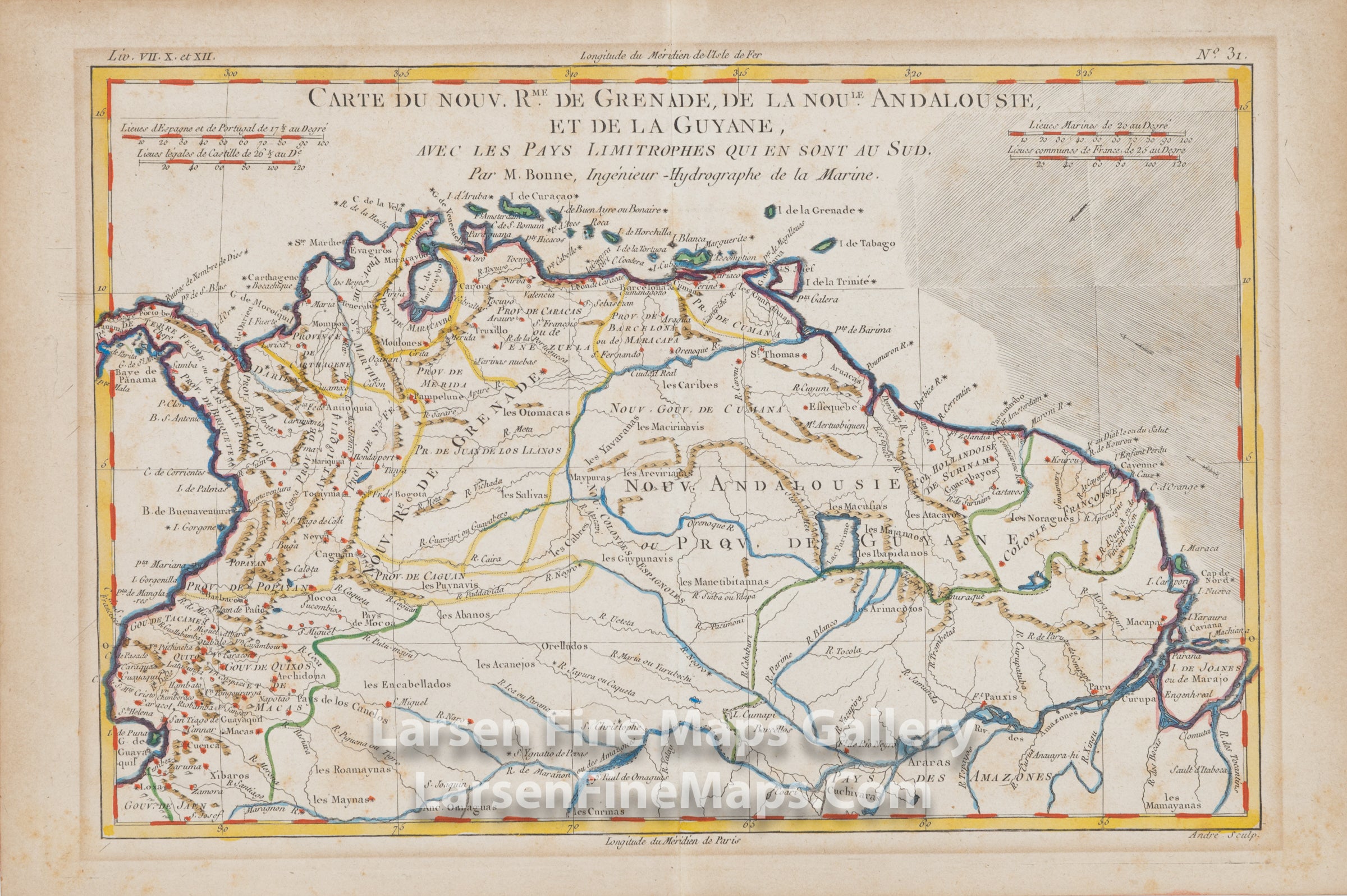
Carte Du Nouv. Rme. De Grenade, De La Noule. Andalousie, Et De La Guyane, Avec Les Pays Limitrophes Qui En Sont Au Sud. Par M. Bonne, Ingenieur - Hydrographe de la Marine.
DESCRIPTION
A nicely detailed map of the northern part of South America. Many place names, waterways, and ports are depicted. Relief shown pictorially. Hand-colored on laid paper with chain lines and watermarks.
FULL TITLE
MAPMAKER/CARTOGRAPHER/AUTHOR
PUBLISHER
PUBLICATION
DIMENSIONS (Inches)
CONDITION
Choose options
DESCRIPTION
FULL TITLE
MAPMAKER/CARTOGRAPHER/AUTHOR
PUBLISHER
PUBLICATION
DIMENSIONS (Inches)
CONDITION
DESCRIPTION
FULL TITLE
MAPMAKER/CARTOGRAPHER/AUTHOR
PUBLISHER
PUBLICATION
DIMENSIONS (Inches)
CONDITION