YEAR PUBLISHED: 1863
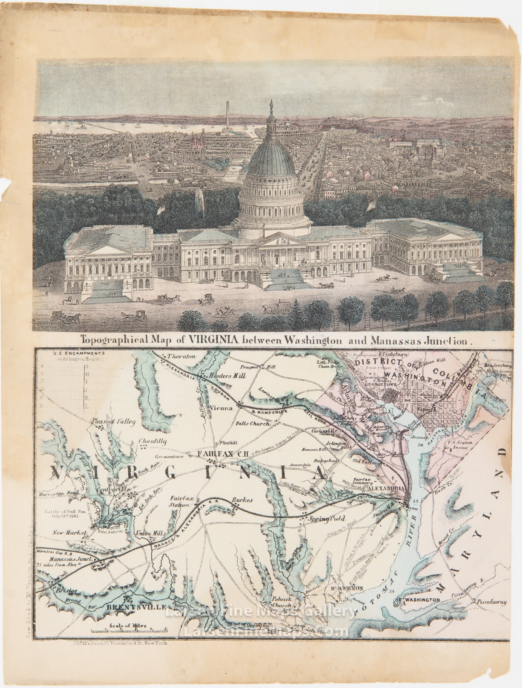
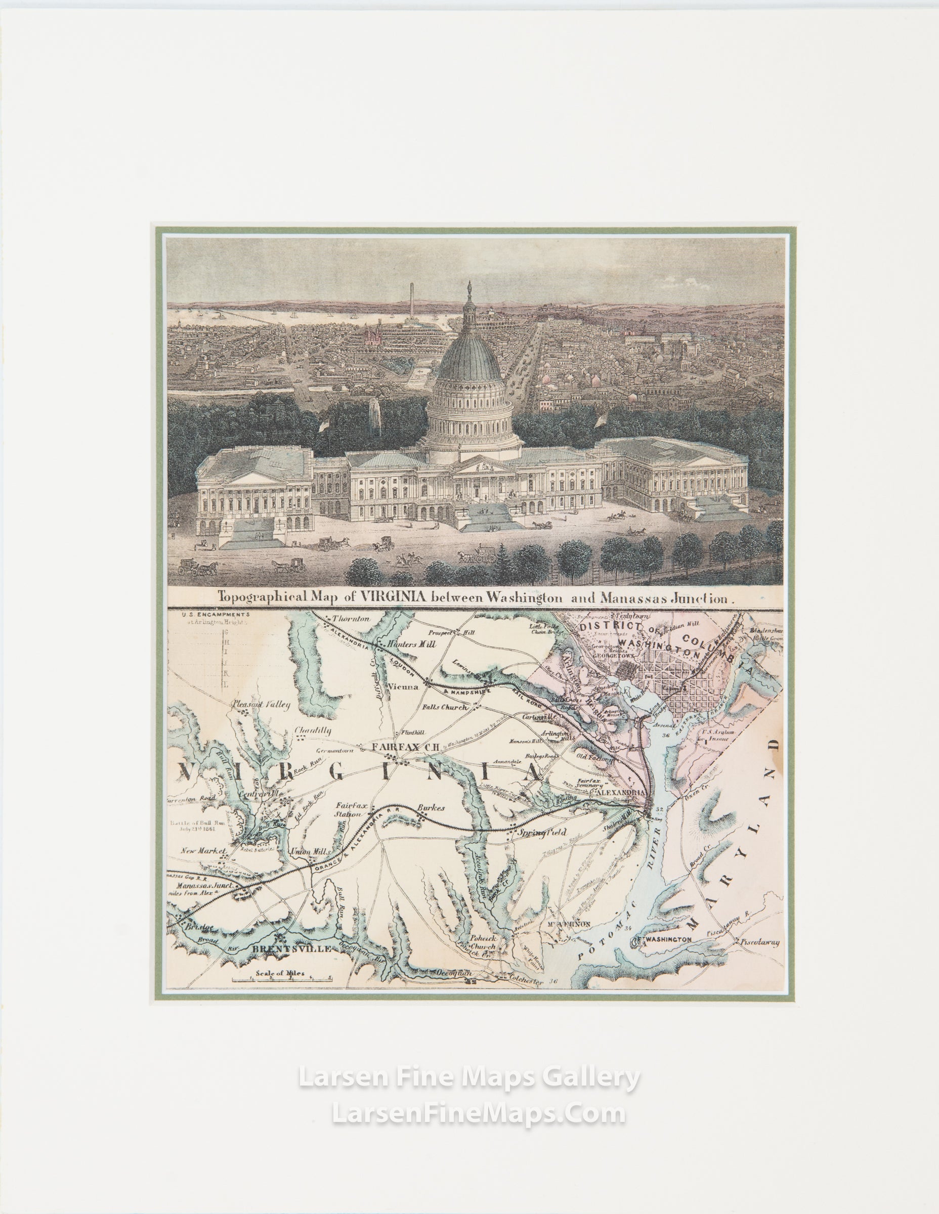
Topographical Map of Virginia between Washington and Manassas Junction
DESCRIPTION
Civil war letter sheet with bird's-eye view of the Capitol on one half and a map of Virginia, Washington DC, and part of Maryland showing encampments and battles.
FULL TITLE
MAPMAKER/CARTOGRAPHER/AUTHOR
PUBLISHER
PUBLICATION
DIMENSIONS (Inches)
CONDITION
Choose options
DESCRIPTION
FULL TITLE
MAPMAKER/CARTOGRAPHER/AUTHOR
PUBLISHER
PUBLICATION
DIMENSIONS (Inches)
CONDITION
DESCRIPTION
FULL TITLE
MAPMAKER/CARTOGRAPHER/AUTHOR
PUBLISHER
PUBLICATION
DIMENSIONS (Inches)
CONDITION