YEAR PUBLISHED: 1865
Set of 6 Charts of the Mississippi River on 3 Sheets, Scarce Complete
DESCRIPTION
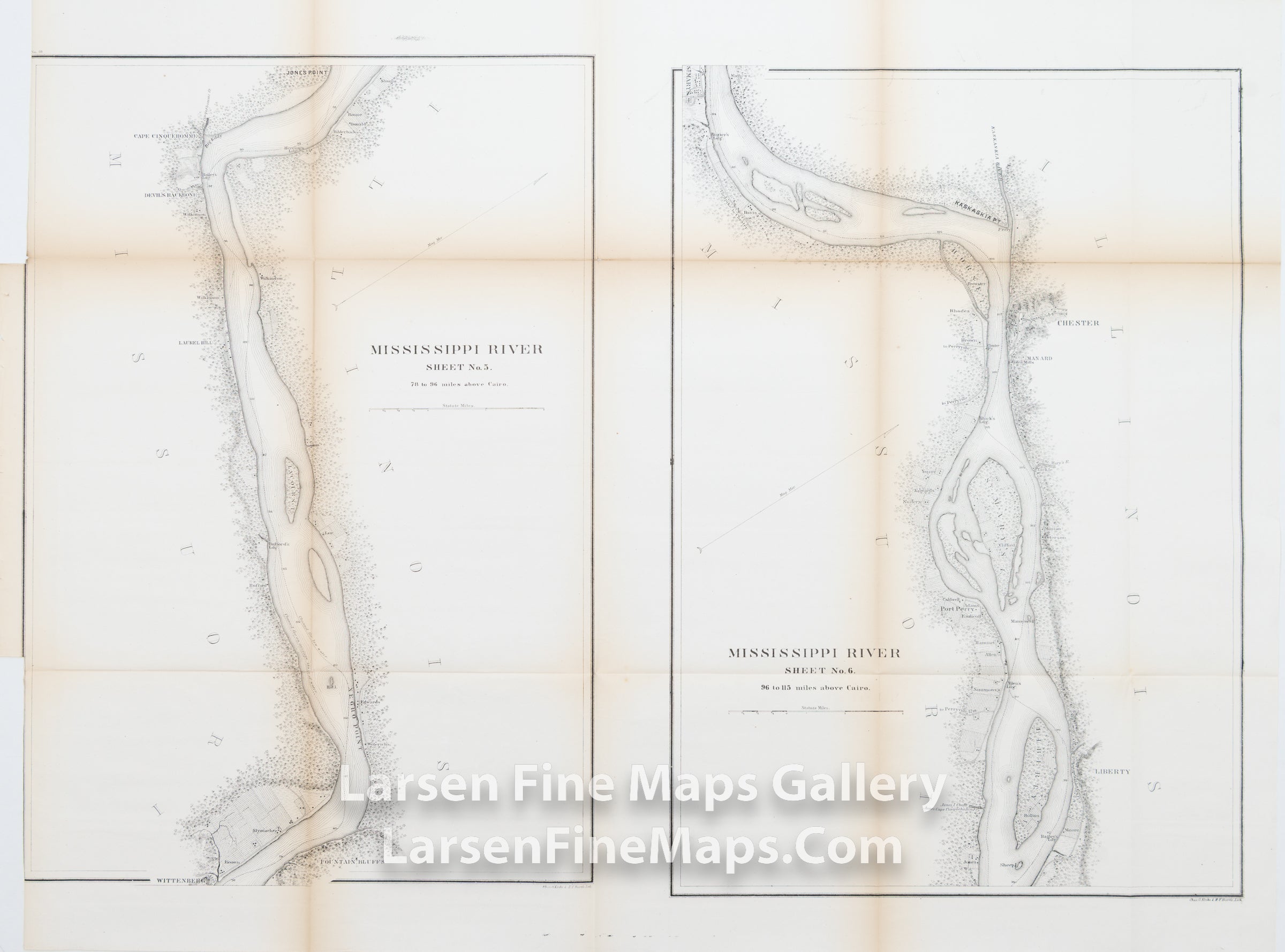
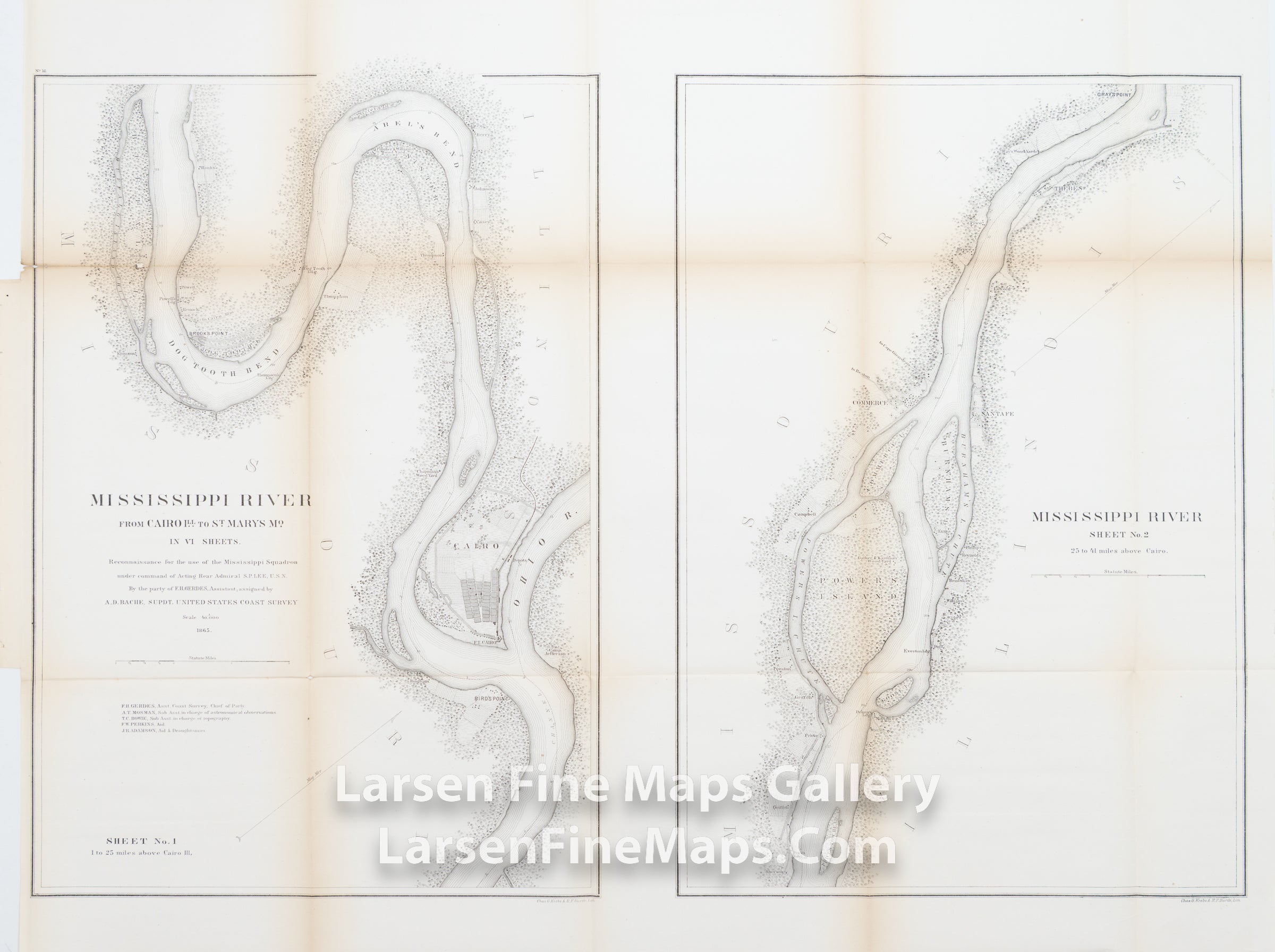
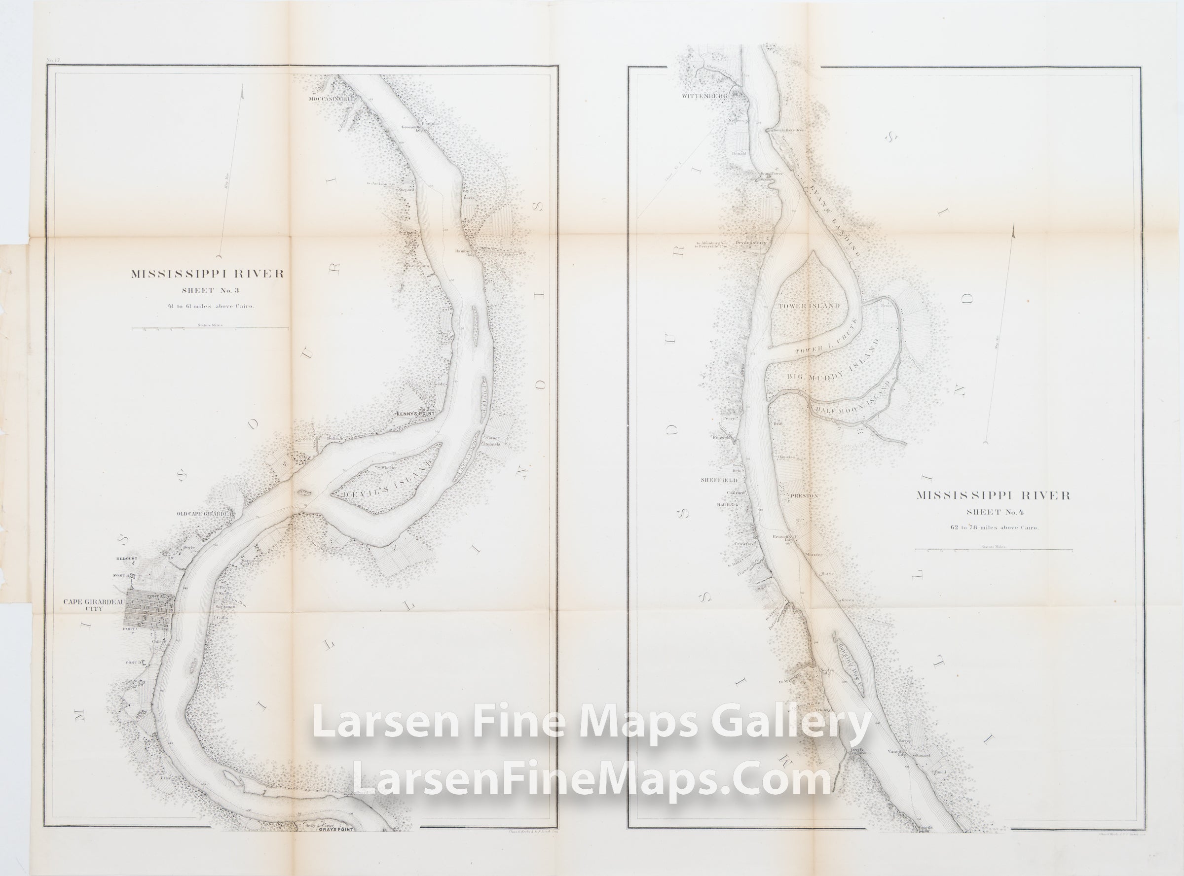
A striking and scarce set of large-scale charts of the Mississippi River (Sheets 1 and 2 on a single sheet, Sheets 3 and 4 on a single sheet, Sheets 5 and 6 on a single sheet). The charts show the course along with mile markers along the river channel, named portions of the river, vegetation, farms, settlements, ownership, landings, islands, places, and similar features.
IMPORTANT NOTE:
All of our United States Coast Survey (USCS), United States Coast & Geodetic Survey (USC&GS), and similar maps and charts have been professionally unfolded and flattened using humidity baths, semi-permeable membrane, and drying blotter techniques. Most others you typically see on eBay have not been, and worse, are quickly and crudely unfolded for the low-quality photos you see. Unfolding these maps in that way is damaging and weakens them. Please be aware.
FULL TITLE
MAPMAKER/CARTOGRAPHER/AUTHOR
PUBLISHER
PUBLICATION
DIMENSIONS (Inches)
CONDITION
Choose options
DESCRIPTION
FULL TITLE
MAPMAKER/CARTOGRAPHER/AUTHOR
PUBLISHER
PUBLICATION
DIMENSIONS (Inches)
CONDITION
DESCRIPTION
FULL TITLE
MAPMAKER/CARTOGRAPHER/AUTHOR
PUBLISHER
PUBLICATION
DIMENSIONS (Inches)
CONDITION