YEAR PUBLISHED: 1786
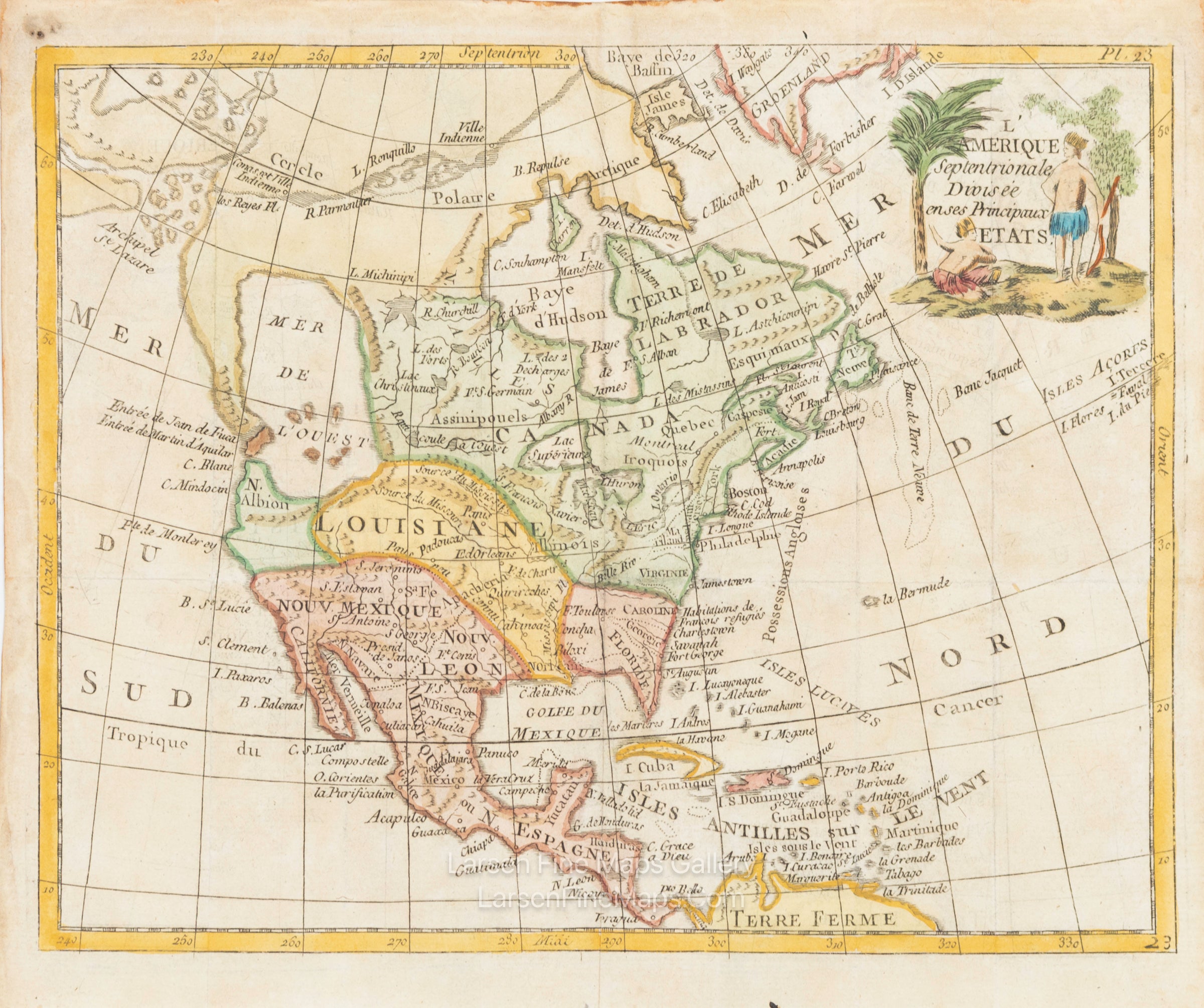
L'Amerique Septentrionale Divisee en Ses Principaux Etats
DESCRIPTION
Striking and highly detailed fine unusual 1786 Joseph de la Porte's copper engraved map of the North American Continent showing the imaginary Mer de l'Ouest (Sea of the West) and a Northwest Passage stretching from Baffin Bay to the Archipel St. Lazare. There is not yet any sign of a recognizable Alaska. The British colonies are confined on the eastern seaboard with the huge French Louisiana territory stretching to the Pacific Northwest. Ft. Cenis is located in present-day Texas, and Habitations de Francois refugies appear above Charleston. The simple title cartouche features two Native Americans. The map is apparently based on Janvier's map of the same title. This map was included in a scarce miniature atlas.
References: McGuirk #169.
FULL TITLE
MAPMAKER/CARTOGRAPHER/AUTHOR
PUBLISHER
PUBLICATION
DIMENSIONS (Inches)
CONDITION
Choose options
DESCRIPTION
FULL TITLE
MAPMAKER/CARTOGRAPHER/AUTHOR
PUBLISHER
PUBLICATION
DIMENSIONS (Inches)
CONDITION
DESCRIPTION
FULL TITLE
MAPMAKER/CARTOGRAPHER/AUTHOR
PUBLISHER
PUBLICATION
DIMENSIONS (Inches)
CONDITION