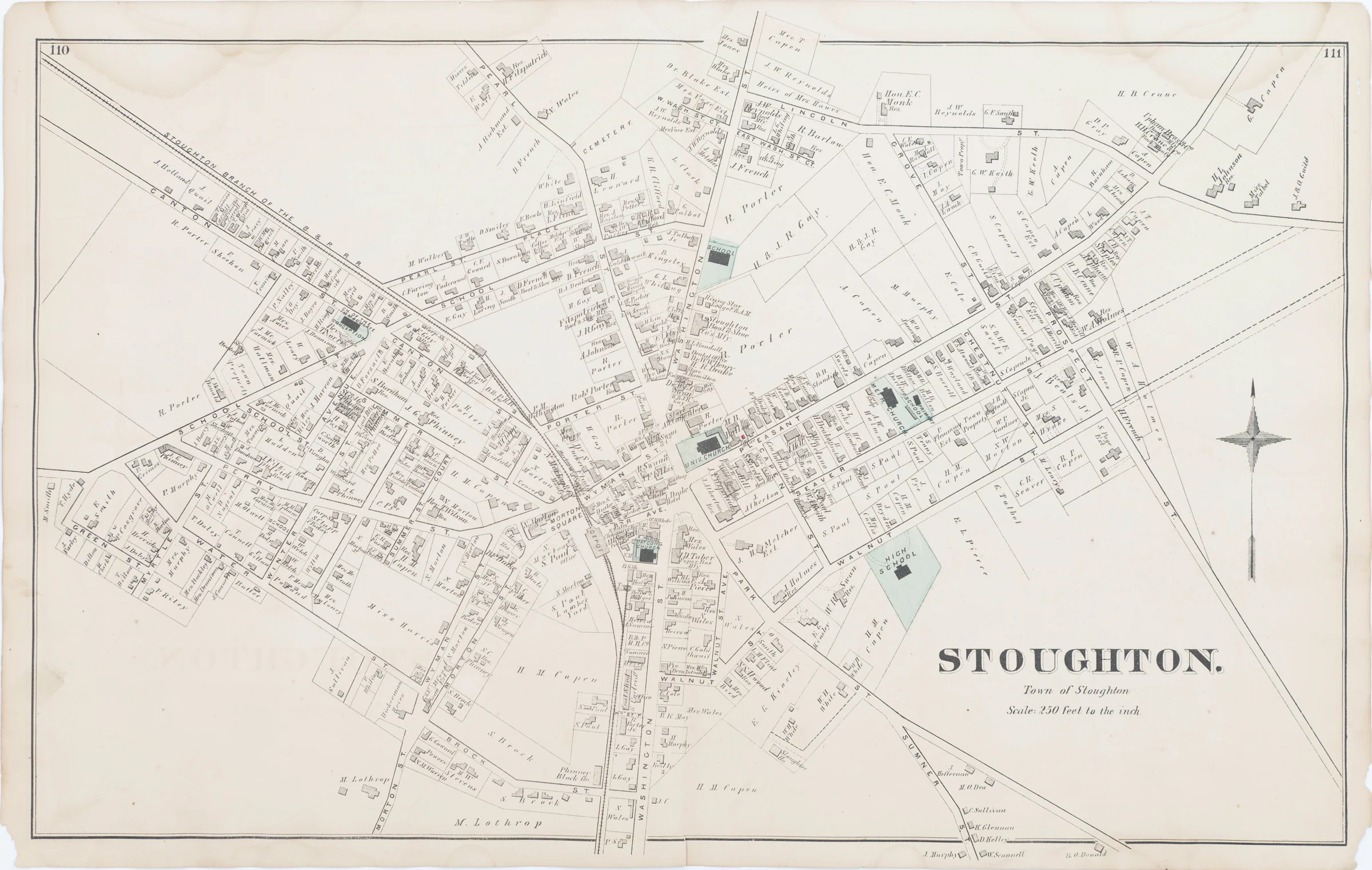
Stoughton, Town of Stoughton, Belcher's Corner, North Stoughton, West Stoughton, Comstock Cline, Edward Busch

$50 and Under Antique Maps, Rare Maps, Charts and Atlases, and Old World Maps

Antique maps, vintage maps, rare maps, charts and atlases under $50.

Old world maps. Browse online to see photos and deals.

178 products
Sort by
Sort by
Topographic Drawings by E. Hergesheimer, Assistant. U.S. Coast SurveyTopographic Drawings by E. Hergesheimer, Assistant. U.S. Coast Survey, details
U.S. Coast Survey A.D. Bache Supdt. Preliminary Chart of Eastport Harbor Maine U.S. Coast Survey
U.S. Coast Survey A.D. Bache Supdt. Sketch Showing the Progress of The Survey on the Atlantic Gulf of Mexico and Pacific Coast of The United States, To November 1864 U.S. Coast Survey
U.S. Coast Survey A.D. Bache Superintendent, Sketch A Showing the Primary Triangulation in Section I and the Connection of The Baselines in Sections I and II From 1844 to 1864 U.S. Coast Survey
U.S. Coast Survey A.D. Bache Superintendent, Sketch J, Showing the progress of the Survey of the Western Coast 1849-55 U.S. Coast Survey
Upper Sheet, U.S. Coast Survey A.D. Bache Superintendent Sketch A Showing the Progress of the Survey in Section No. 1 From 1852 to 1864 U.S. Coast Survey
Wawona Tree Photogravure, Henry Ihlefeld, JohnMuir, J. Dewing California Antique Print
Weber Lower Canon. From an Island in Weber River, Valley of Great Salt Lake, C. Schumann from  Friedrich Wilhelm von Egloffstein. Engraved by S.V. Hunt
West end of Madelin Pass from a peak overlooking Madelin Creek, C. Schumann from  Friedrich Wilhelm von Egloffstein. Engraved by S.V. Hunt
World War II WW2 Ephemera, Photos, Postcards, Mare Island Ships LotWorld War II WW2 Ephemera, Photos, Postcards, Mare Island Ships Lot Example-1