
YEAR PUBLISHED: 1848
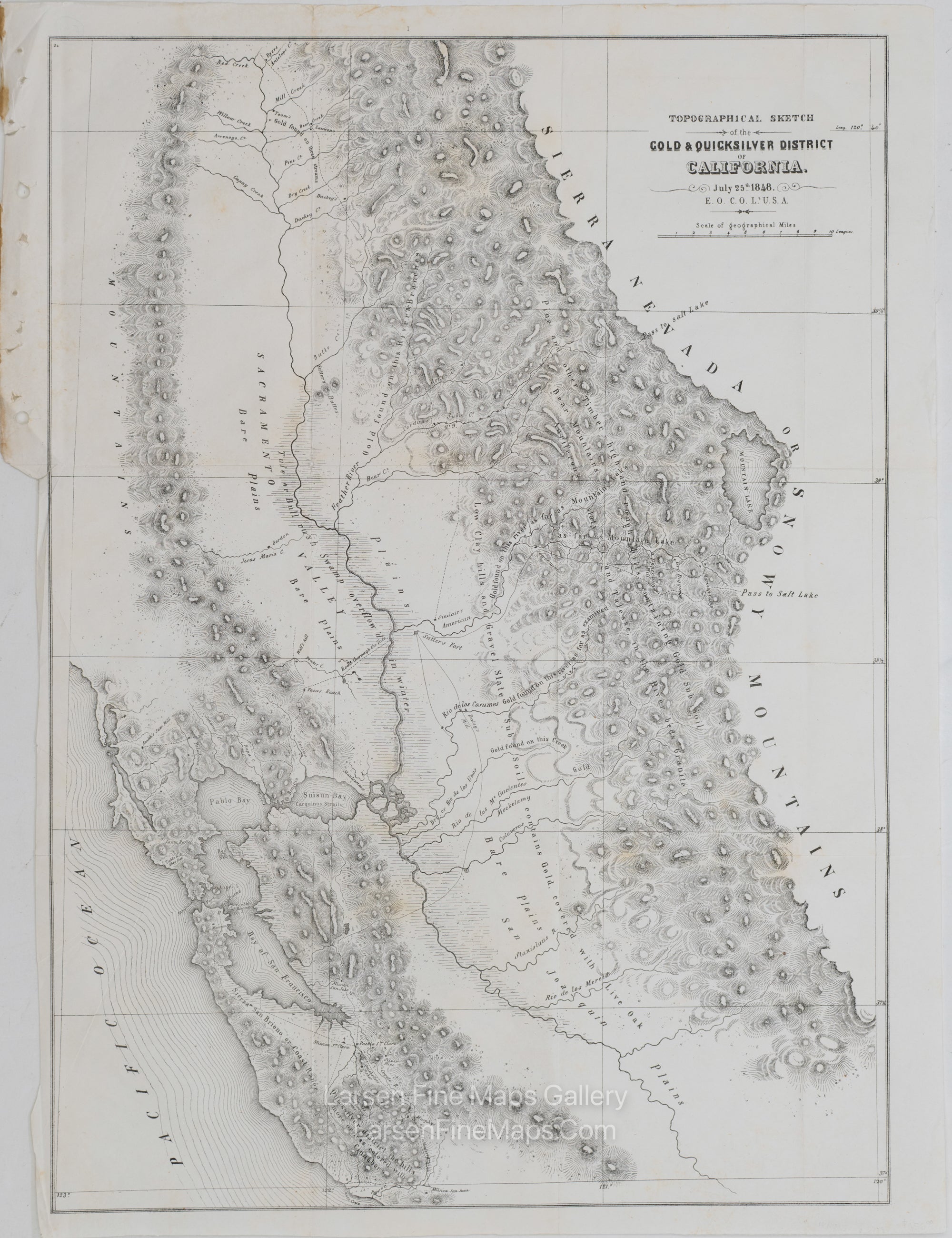
Topographical Sketch of the Gold & Quicksilver District of California. July 25th 1848
DESCRIPTION
Highly important map of the Gold Region which accompanied Col. R.B. Mason's report on the recent discovery of gold along the Sacremento River, which is generally regarded as the earliest obtainable map of the California Gold Regions based upon actual observations. This map is the first serious effort at cartographic detail and accuracy in the region, which launched thousands of 49ers westerward. The map covers the Sacramento and San Joaquin Valleys to the coast. A number of early gold strikes are shown. San Francisco is Yerba Buena. Many other interesting features. The first official map of the Gold Regions in California.
FULL TITLE
MAPMAKER/CARTOGRAPHER/AUTHOR
PUBLISHER
PUBLICATION
DIMENSIONS (Inches)
CONDITION
Choose options
DESCRIPTION
FULL TITLE
MAPMAKER/CARTOGRAPHER/AUTHOR
PUBLISHER
PUBLICATION
DIMENSIONS (Inches)
CONDITION
DESCRIPTION
FULL TITLE
MAPMAKER/CARTOGRAPHER/AUTHOR
PUBLISHER
PUBLICATION
DIMENSIONS (Inches)
CONDITION