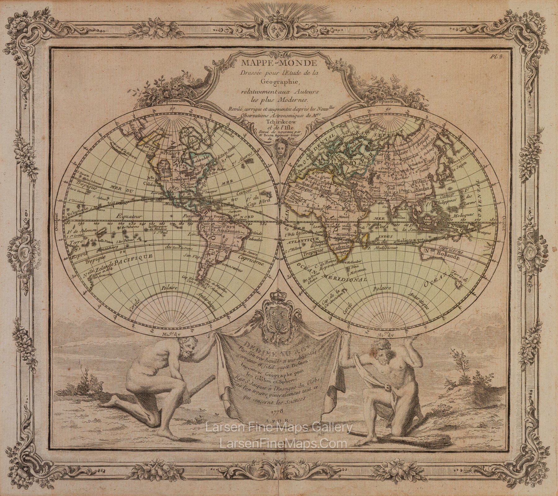
YEAR PUBLISHED: 1778
Mappe-monde Dressée pour l'Étude de la Géographie
DESCRIPTION
A striking double-hemisphere map of the World with beautiful border and cartouche artwork and engravings.
North America, particularly the Northwestern quadrants, is exciting and speculative. A magnificent inland sea, called the Sea of the West or the Mer de L'Ouest, is in the northwestern part of America. This body of water, alternatively called the Sea of the West or Baye de l'Ouest, was speculated by Philippe Buache and De l'Isle in the early 18th century based upon wishful thinking, American Indian stories, and the somewhat questionable 16th-century explorations of Juan de Fuca. Here, Brion gives the Mer de l'Ouest its fullest expression, though he specifically does not connect it to the factual network of lakes and rivers extending westward from the Hudson Bay.
South of the equator, the shores of Australia or New Holland are speculatively mapped with a dotted line defining the southern and eastern portions of the continent. Van Diemen's Land, or Tasmania, is attached to the mainland, including New Guinea and parts of the New Hebrides.
Polynesia is mapped with numerous islands named. What is shown is 'Terre de Davis' roughly where Easter Island is today. Terre de Davis, or Davis' Land, was supposedly discovered in 1688 by an English navigator of the same name. Many historians argue whether or not Davis Land was Easter Island, but it does seem likely.
The map includes a beautiful rococo-style title cartouche in the top center and another cartouche at the bottom, featuring the dedication and the coat of arms of France held up by Atlas and Hercules, on whose backs the hemispheres are supported.
FULL TITLE
MAPMAKER/CARTOGRAPHER/AUTHOR
PUBLISHER
PUBLICATION
DIMENSIONS (Inches)
CONDITION
