YEAR PUBLISHED: 1800
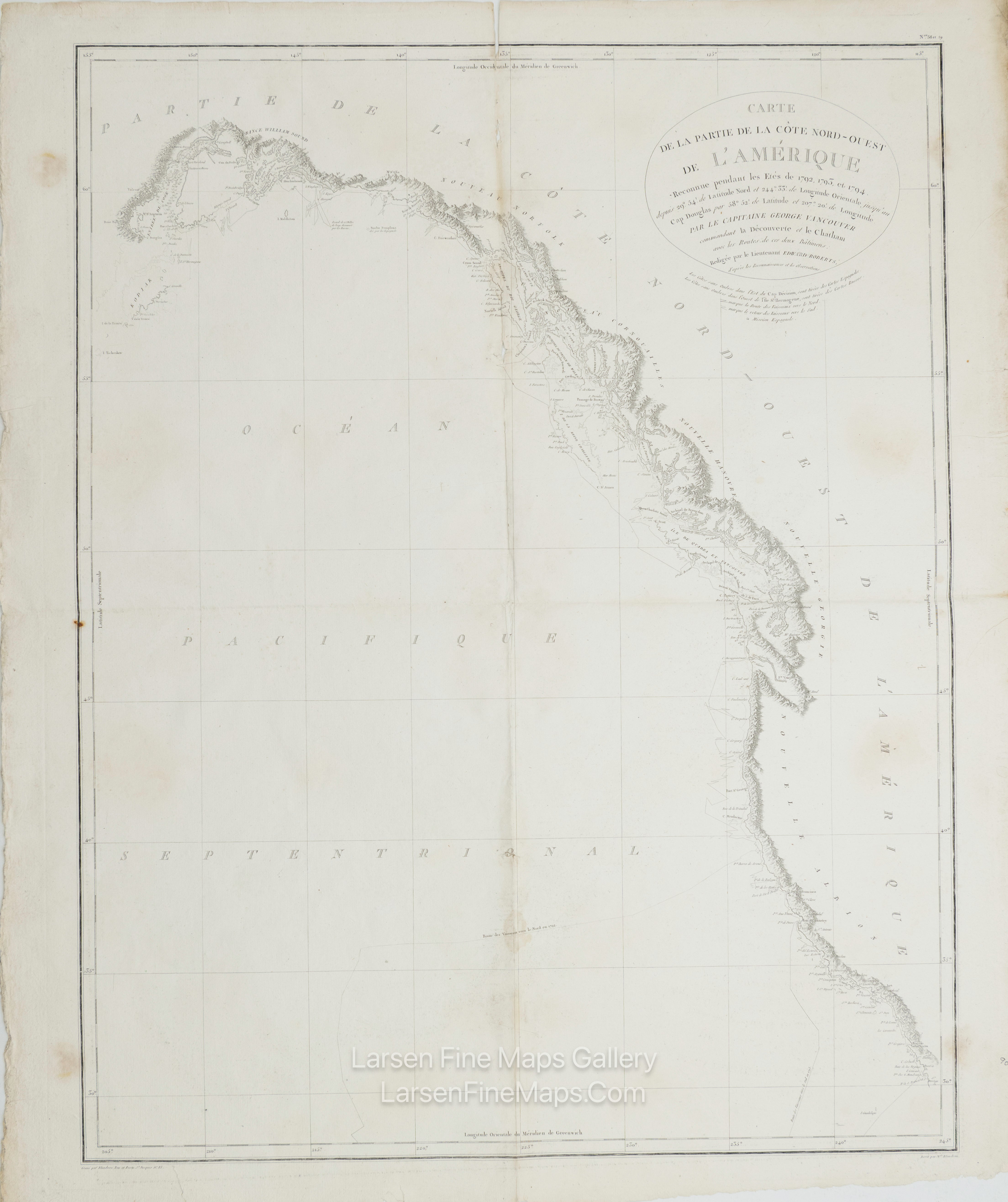
Carte De La Partie De La Cote Nord-Ouest De L'Amerique Reconne pendant les Etes de 1792, 1793, et 1794.
DESCRIPTION
Striking and highly detailed, fine, unusual copper-engraved large-format George Vancouver's 1799 sea chart gave a general reconnaissance of the west coast of America from San Diego to Kodiak Island, Alaska. At last, the west coast of America, particularly the Pacific Northwest, appears on the map much as it is in reality. This beautifully engraved map features a number of notable firsts, including the first published mapping of the Puget Sound, the first mapping of Vancouver as an Island, the first mapping of the Johnston Strait, and the first published map of the Columbia River. Vancouver's mapping of the Columbia River, which he initially missed, was of crucial importance to the development of the western fur trade. Just five years after this map was published, Lewis and Clark would consult it when planning their important overland expedition to America's west coast. The subsequent opening of the west to the fur trade heightened British and American rivalries in the region as well as ushered in the Great Age of the Mountain Men. Mount Rainier, Mt. St. Helene, and Mount Baker are all noted, Baker being named after one of Vancouver's Lieutenants. San Francisco Harbor is noted as 'Port Sd. Francisco.' Slightly further north, Drake's Harbor appears. Here, Sir Frances Drake supposedly wintered in 1579 and, in the process, claimed the American northwest as New Albion for England. Vancouver's tracks in 1792, 1793, and 1794 are noted. The incredible detail of this chart, the finest mapping of the American west coast to appear for nearly 90 years after its publication, is an extraordinary monument to Vancouver's meticulous nature.
This particular example of Vancouver's map was issued as plate no. 3 in the highly desirable 1799 French edition of Vancouver's Atlas. It was drawn by Lieutenant Edward Roberts and engraved by Blondeau. The rare and coveted French edition of Vancouver's Atlas is more beautifully produced, with better engraving, higher-quality paper, and more detail than the 1798 English edition. This scarce map is a core piece for any serious collection focusing on California, Vancouver, British Columbia, or the Pacific Northwest.
FULL TITLE
MAPMAKER/CARTOGRAPHER/AUTHOR
PUBLISHER
PUBLICATION
DIMENSIONS (Inches)
CONDITION
Choose options

DESCRIPTION
FULL TITLE
MAPMAKER/CARTOGRAPHER/AUTHOR
PUBLISHER
PUBLICATION
DIMENSIONS (Inches)
CONDITION
DESCRIPTION
FULL TITLE
MAPMAKER/CARTOGRAPHER/AUTHOR
PUBLISHER
PUBLICATION
DIMENSIONS (Inches)
CONDITION