YEAR PUBLISHED: 1879
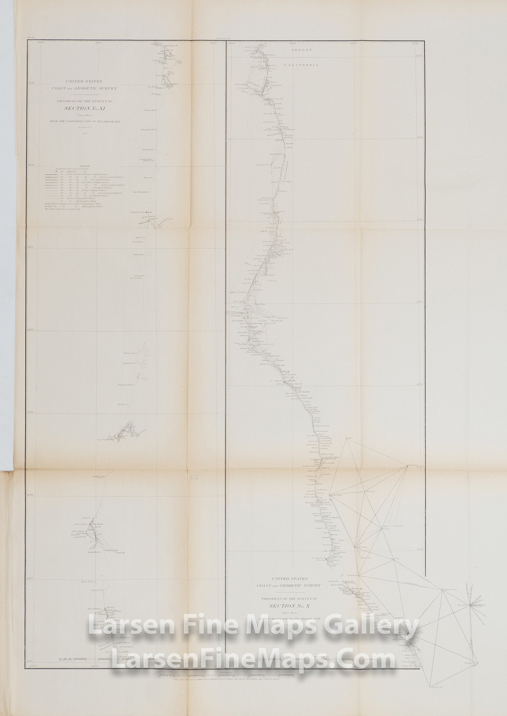
Sketch Showing the Progress of the Survey in Section X (Upper Sheet). Coast of California from Tomales Bay to the Oregon line, and Section XI (Lower Sheet), Coast of Oregon, from the California line to Tilllamook Bay
DESCRIPTION
This is an interesting map as it is actually two maps on one sheet. Two stretches of the western coast of the United States are shown in vertical sections of the map. On the left is the progress of the survey and triangulation from the California line to Tillamook Bay (this is the lower sheet of the upper 2-sheet set of coast maps) and on the right is the coast from Tomales Bay to the Oregon Line (this is the upper sheet of the lower 3-sheet coast map set). A fairly detailed coast with place names and triangulation points are shown.
IMPORTANT NOTE:
All of our United States Coast Survey (USCS), United States Coast & Geodetic Survey (USC&GS), and similar maps and charts have been professionally unfolded and flattened using humidity baths, semi-permeable membrane, and drying blotter techniques. Most others you typically see on eBay have not been, and worse, are quickly and crudely unfolded for the low-quality photos you see. Unfolding these maps in that way is damaging and weakens them. Please be aware.
FULL TITLE
MAPMAKER/CARTOGRAPHER/AUTHOR
PUBLISHER
PUBLICATION
DIMENSIONS (Inches)
CONDITION
Choose options
DESCRIPTION
FULL TITLE
MAPMAKER/CARTOGRAPHER/AUTHOR
PUBLISHER
PUBLICATION
DIMENSIONS (Inches)
CONDITION
DESCRIPTION
FULL TITLE
MAPMAKER/CARTOGRAPHER/AUTHOR
PUBLISHER
PUBLICATION
DIMENSIONS (Inches)
CONDITION