YEAR PUBLISHED: 1795
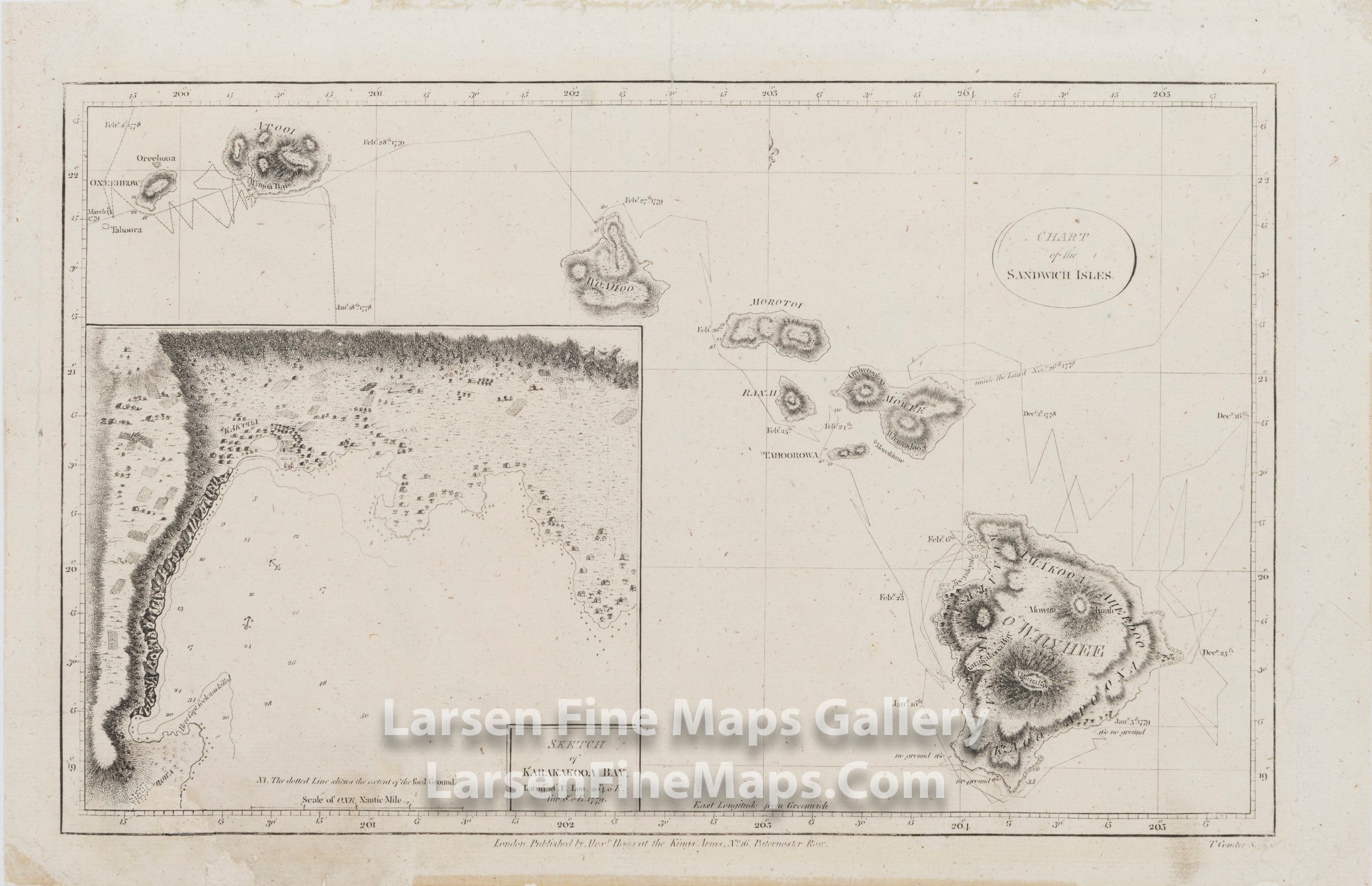
Chart of the Sandwich Islands; Sketch of Karakakooa Bay. Lat. 19°.28' N. Lon., 20°4.0' E. Var. 8°.0' E. 1779
DESCRIPTION
This is a striking map of Captain James Cook's discovery and visit to the Sandwich Islands (Hawaiian Islands). This is the first map of the Sandwich Islands and shows his journey around and through the archipelago. Island and place names are shown along with hachures showing relief.
There is a very nice and large inset of “Karakakooa Bay” (present-day Kealakekua Bay on the island of Hawai’i) The inset map shows a fair amount of detail of the area where Cook spent some time before being killed by the Sandwich Islanders on February 14, 1779.
This is a later edition published by Alexander Hogg in 1795, as can be identified by the circle around the title, which is unique to the Hogg edition.
FULL TITLE
MAPMAKER/CARTOGRAPHER/AUTHOR
PUBLISHER
PUBLICATION
DIMENSIONS (Inches)
CONDITION
Choose options

DESCRIPTION
FULL TITLE
MAPMAKER/CARTOGRAPHER/AUTHOR
PUBLISHER
PUBLICATION
DIMENSIONS (Inches)
CONDITION
DESCRIPTION
FULL TITLE
MAPMAKER/CARTOGRAPHER/AUTHOR
PUBLISHER
PUBLICATION
DIMENSIONS (Inches)
CONDITION