YEAR PUBLISHED: 1729
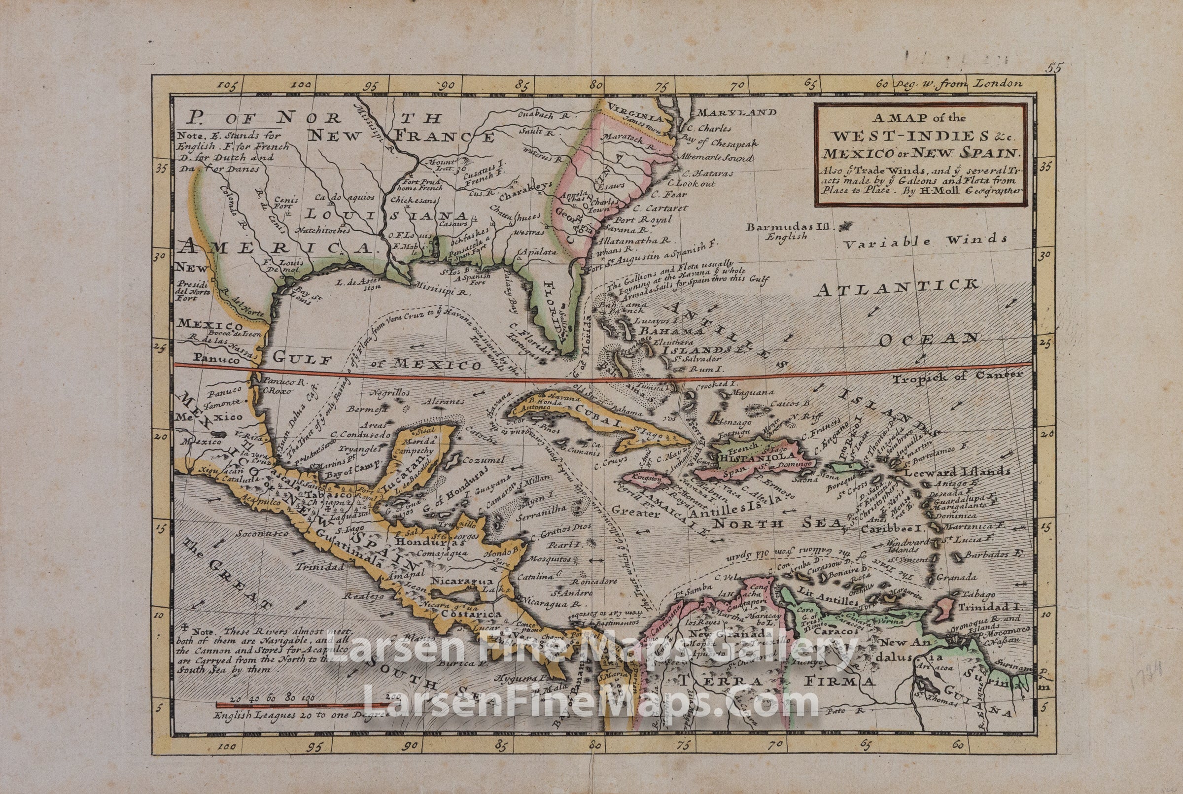
A Map of the West-Indies & c. Mexico or New Spain
DESCRIPTION
Striking full color example of this attractive map of the Spanish Main generally consisting of the West Indies, Central America, Eastern Mexico, the Southern portion of North America including some of the British Colonies, and the Northern portion of South America.
The map shows great detail with an interesting depiction of the coast lines, Florida, Yucatan and the Gulf Coast. The map shows territorial claims (designated by letter as noted in the upper left of the map), forts, ports, towns, waterways, mountains, lakes, islands, and a very interesting notation describing the navigable rivers through New Spain through which cannons and stores were brought to Acapulco. The most interesting characteristic of this map are the tracts of the Spanish treasure Galleons (noted 'Galeons and Flota" as well as "Gallions" on the map) along with commentary on those tracts.
The map shows great detail with an interesting depiction of the coast lines, Florida, Yucatan and the Gulf Coast. The map shows territorial claims (designated by letter as noted in the upper left of the map), forts, ports, towns, waterways, mountains, lakes, islands, and a very interesting notation describing the navigable rivers through New Spain through which cannons and stores were brought to Acapulco. The most interesting characteristic of this map are the tracts of the Spanish treasure Galleons (noted 'Galeons and Flota" as well as "Gallions" on the map) along with commentary on those tracts.
FULL TITLE
MAPMAKER/CARTOGRAPHER/AUTHOR
PUBLISHER
PUBLICATION
DIMENSIONS (Inches)
CONDITION
Choose options
DESCRIPTION
FULL TITLE
MAPMAKER/CARTOGRAPHER/AUTHOR
PUBLISHER
PUBLICATION
DIMENSIONS (Inches)
CONDITION
DESCRIPTION
FULL TITLE
MAPMAKER/CARTOGRAPHER/AUTHOR
PUBLISHER
PUBLICATION
DIMENSIONS (Inches)
CONDITION