YEAR PUBLISHED: 1638
Nova Belgica Et Anglia Nova
DESCRIPTION
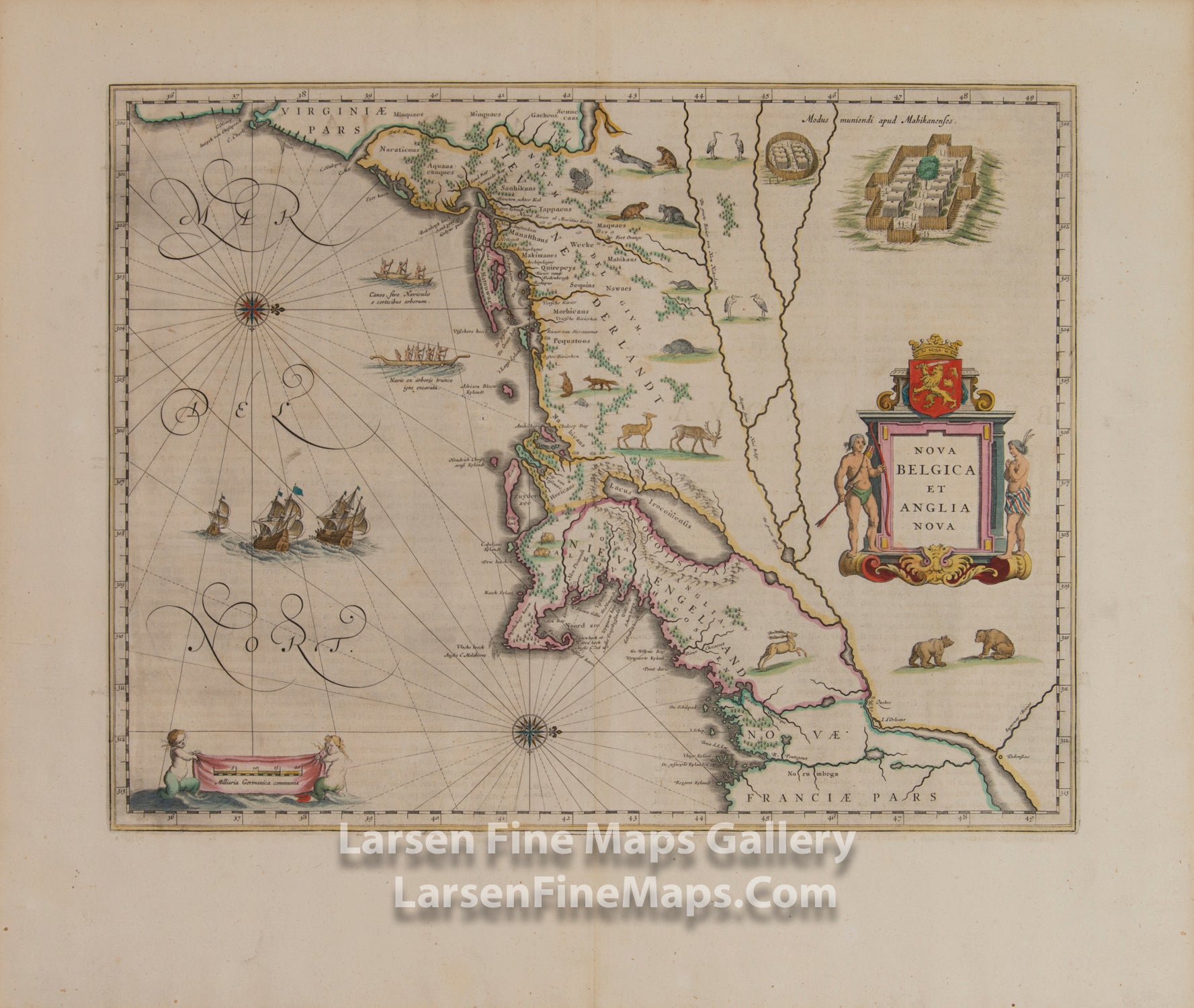
This is a striking example of one of the most important North American maps of the early 17th century. Blaeu largely took information from Adriaen Block’s 1614 manuscript map of the region and information gleaned from Dutch fur traders of the time. The map is oriented to the west, with coverage of New England and the Middle Atlantic states, from Penobscot Bay to the mouth of Chesapeake Bay. It is known as the first map to depict Manhattan as an Island and show beavers and polecats. The map is adorned with a great many depictions of North American wildlife, including deer, foxes, bears, egrets, rabbits, cranes, turkeys, beavers, polecats, and otters. Also shown are fortified Indian villages, two canoes with Indians paddling, and presumably Dutch sailing ships. Indian tribes such as “Maques” Mohawks and “Mahicans” Mohegans are also identified.
This map was first published in Amsterdam in 1635 and had 12 subsequent editions, equally in Latin, German, Dutch, and French.
This edition has Latin text on verso.
FULL TITLE
MAPMAKER/CARTOGRAPHER/AUTHOR
PUBLISHER
PUBLICATION
DIMENSIONS (Inches)
CONDITION
Choose options
DESCRIPTION
FULL TITLE
MAPMAKER/CARTOGRAPHER/AUTHOR
PUBLISHER
PUBLICATION
DIMENSIONS (Inches)
CONDITION
DESCRIPTION
FULL TITLE
MAPMAKER/CARTOGRAPHER/AUTHOR
PUBLISHER
PUBLICATION
DIMENSIONS (Inches)
CONDITION