YEAR PUBLISHED: 1720
Amplissimae Regionis Mississipi seu Provinciae Ludovicianae
DESCRIPTION
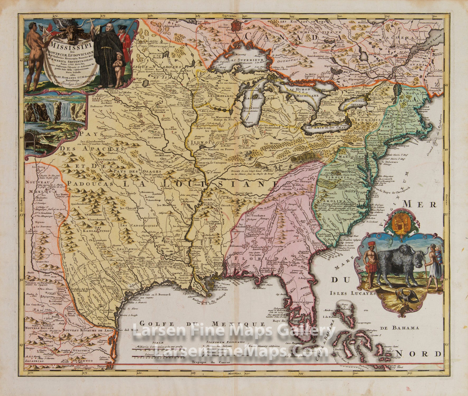
An exemplary map of the Mississippi River Valley and the eastern part of the American continent. Commonly called the 'Buffalo Map' for its distinctive decorative cartouche showing a stylized buffalo, this map is derived from the reports of Hennepin, who explored the upper Mississippi and Great Lakes regions as a Jesuit Missionary in the late 1600s as well as an earlier 1718 map of the same region by G. De L'Isle.
The map covers much of the modern-day United States from Mexico, New Mexico, and Texas north to Canada and the Great Lakes and from Florida Keys, north along the entire Eastern Seaboard to northeastern Canada.
The political divisions of the time are shown in vivid color and include Nouveau Mexique (pink) along and then parallel to the Rio de Norte (Rio Grande), La Louisiane (yellow) covering from present-day Texas to Alabama and north to include all five of the Great Lakes, and both the upper and lower Mississippi River Valleys to the western border of the English Colonies, Florida (pink) consisting most of the American southeast, the English Colonies (green) along the Atlantic seaboard, and finally Canada (pink) comprising the upper portion of the map north of the Great Lakes.
The map shows various explorers' routes, settlements, Indian tribes, villages, water courses, topography (shown pictorially), forts, harbors, ports, and other locations noted. More cartouche artistry depicts Niagara Falls, , wildlife, a native, a Franciscan Priest, and an English soldier.
FULL TITLE
MAPMAKER/CARTOGRAPHER/AUTHOR
PUBLISHER
PUBLICATION
DIMENSIONS (Inches)
CONDITION
Choose options
DESCRIPTION
FULL TITLE
MAPMAKER/CARTOGRAPHER/AUTHOR
PUBLISHER
PUBLICATION
DIMENSIONS (Inches)
CONDITION
DESCRIPTION
FULL TITLE
MAPMAKER/CARTOGRAPHER/AUTHOR
PUBLISHER
PUBLICATION
DIMENSIONS (Inches)
CONDITION