YEAR PUBLISHED: 1760
A Map of the Icy Sea
DESCRIPTION
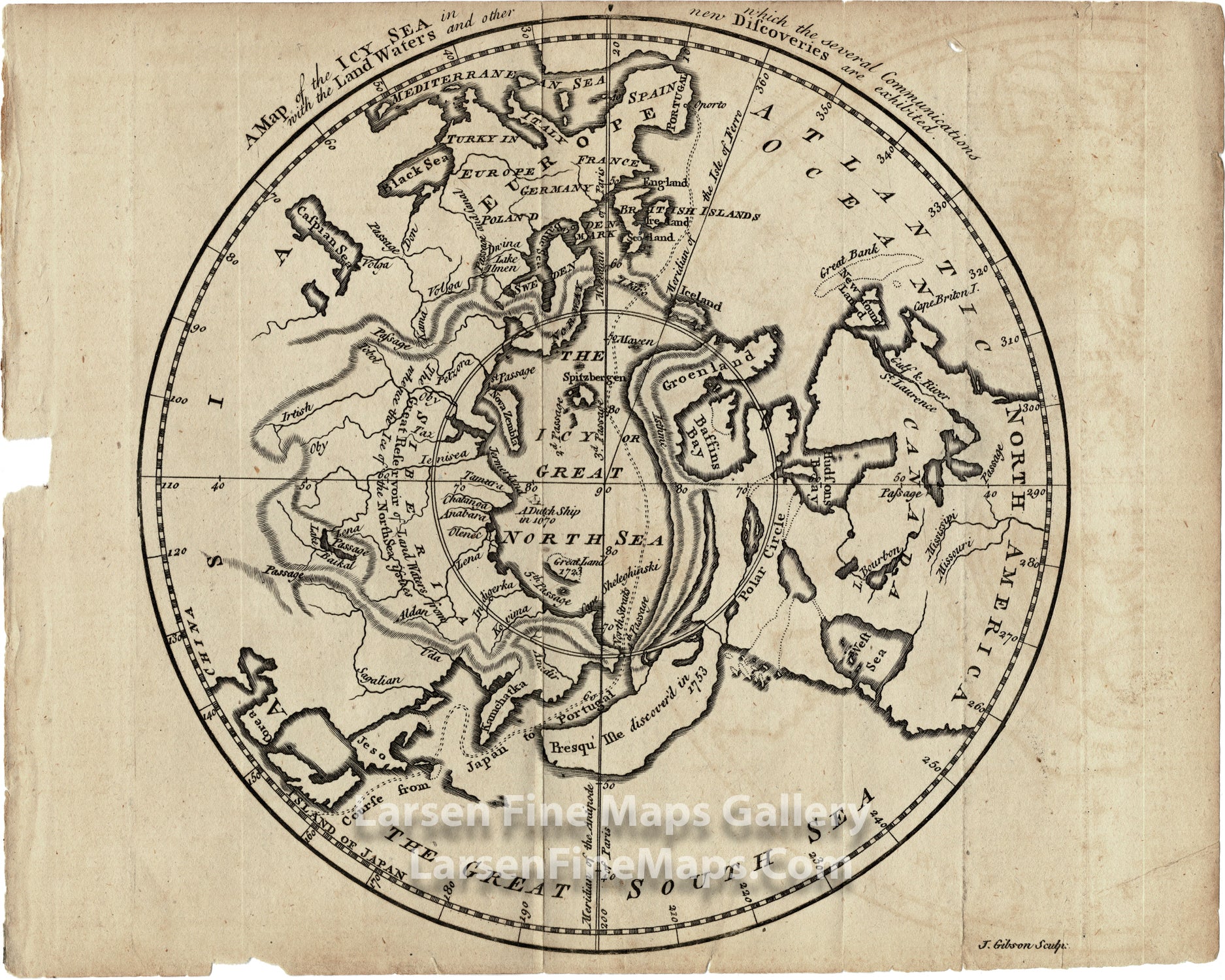
An interesting mid-eighteenth-century map of the northern Polar regions on a north hemispheric projection. The map focuses on the North Pole and the ever-elusive Northwest Passage. There are 5 passages across the "Icy Sea" labeled 1st through 5th and presumably showing options for the routes. The map specifically also depicts the hopeful course from Japan to Portugal as a double dashed line. The West Sea, a version of the mythical Sea of the West, which imaginatively connects to another large inland lake all interconnected via dotted lines to Hudson's Bay is present. Land passages between Europe and Asia are shown pictorially with hachures. The recorded position of a Dutch ship in 1670 off the coast of Siberia is indicated by a tiny illustration of the ship. The discoveries of Presque Isle and Great Land are labeled 1723 and 1753 respectively. The various land masses are highly distorted as are the physiographic features.
FULL TITLE
MAPMAKER/CARTOGRAPHER/AUTHOR
PUBLISHER
PUBLICATION
DIMENSIONS (Inches)
CONDITION
Choose options
DESCRIPTION
FULL TITLE
MAPMAKER/CARTOGRAPHER/AUTHOR
PUBLISHER
PUBLICATION
DIMENSIONS (Inches)
CONDITION
DESCRIPTION
FULL TITLE
MAPMAKER/CARTOGRAPHER/AUTHOR
PUBLISHER
PUBLICATION
DIMENSIONS (Inches)
CONDITION