YEAR PUBLISHED: 1802
Charte Von Nord America, C.G. Reichard, Weimar
DESCRIPTION
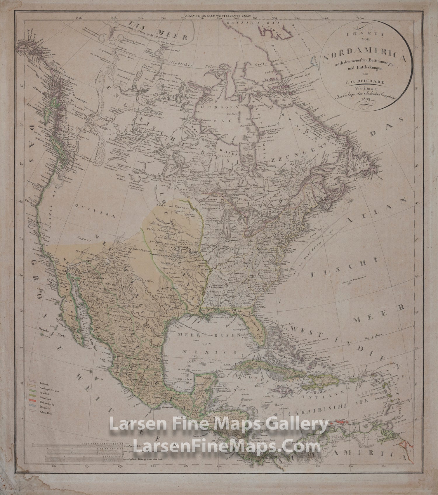
A striking and rare 1802 edition of Reichard’s map of North America, created prior to the Louisiana Purchase and the Lewis and Clark expedition. This map features several intriguing elements typical of early 19th-century cartography, including the legendary "Quivira" in the western United States, the West Coast labeled as "New Albion" with minimal detail, and the short-lived proposed State of Franklin, situated between Virginia and Kentucky. Few maps of this era depict the State of Franklin, making this one highly sought after by collectors of the region.
Notable for its impressive detail along the northwest coast, the map reflects the explorations of George Vancouver, Jean-François de Galaup de La Pérouse, and James Cook. While large expanses are marked as "Quivira," the map also provides considerable detail in other areas, particularly rivers, which are depicted based on contemporary knowledge but with some imaginative conjecture, a common feature in early maps. A colored legend illustrates the various colonial possessions at the time, including those of the British, United States, Spanish, French, Dutch, Danish, and Swedish.
CHRISTIAN GOTTLIEB REICHARD (GERMAN, 1758-1837) MAP OF NORTH AMERICA, hand-colored engraving on paper, "Charte von Nord America nach den neuesten Bestimmungen and Entdeckungen von C. G. Reichard", published 1802 in Weimar.
FULL TITLE
MAPMAKER/CARTOGRAPHER/AUTHOR
PUBLISHER
PUBLICATION
DIMENSIONS (Inches)
CONDITION
Choose options
DESCRIPTION
FULL TITLE
MAPMAKER/CARTOGRAPHER/AUTHOR
PUBLISHER
PUBLICATION
DIMENSIONS (Inches)
CONDITION
DESCRIPTION
FULL TITLE
MAPMAKER/CARTOGRAPHER/AUTHOR
PUBLISHER
PUBLICATION
DIMENSIONS (Inches)
CONDITION