YEAR PUBLISHED: 1867
Inside Passage Between Bath and Booth Bay
DESCRIPTION
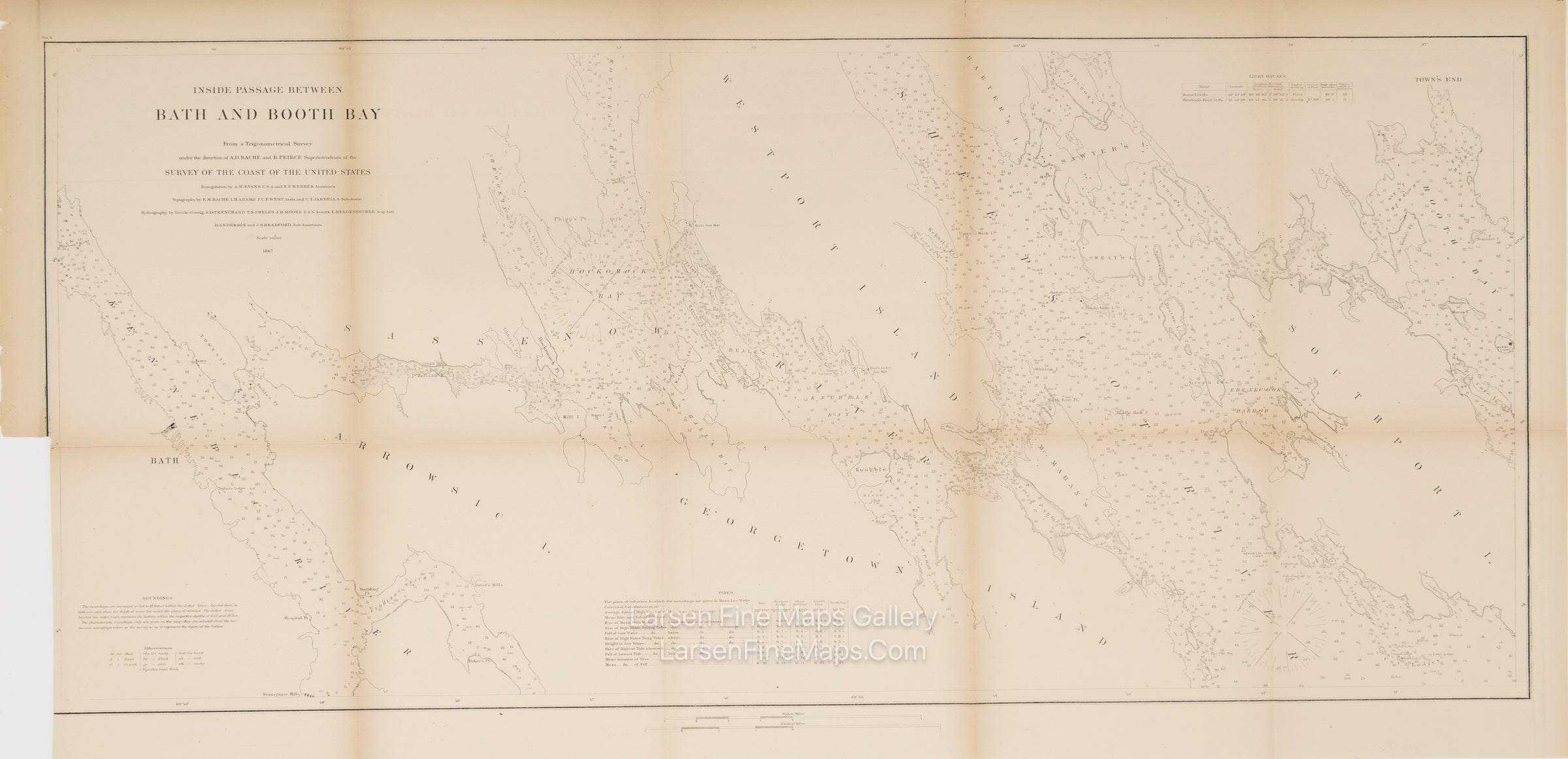
A striking fairly large-scale U.S. Coast Survey chart of the coast from Bath to Booth Bay, Maine, showing numerous soundings, aids and hazards to navigation, points, rocks, islands, lighthouses, along with notes on tides, bottom type, and soundings. Depicted are Tenant's Harbor, town of Hart's Neck, properties, roads, and buildings. Kennebec, Sassenow, and Sheepscot Rivers, Booth Bay, Arrowsic, Georgetown, Westport, and Southport Islands are shown.
IMPORTANT NOTE:
All of our United States Coast Survey (USCS), United States Coast & Geodetic Survey (USC&GS), and similar maps and charts have been professionally unfolded and flattened using humidity baths, semi-permeable membrane, and drying blotter techniques. Most others you typically see on eBay have not been, and worse, are quickly and crudely unfolded for the low-quality photos you see. Unfolding these maps in that way is damaging and weakens them. Please be aware.
FULL TITLE
MAPMAKER/CARTOGRAPHER/AUTHOR
PUBLISHER
PUBLICATION
DIMENSIONS (Inches)
CONDITION
Choose options
DESCRIPTION
FULL TITLE
MAPMAKER/CARTOGRAPHER/AUTHOR
PUBLISHER
PUBLICATION
DIMENSIONS (Inches)
CONDITION
DESCRIPTION
FULL TITLE
MAPMAKER/CARTOGRAPHER/AUTHOR
PUBLISHER
PUBLICATION
DIMENSIONS (Inches)
CONDITION