
YEAR PUBLISHED: 1798
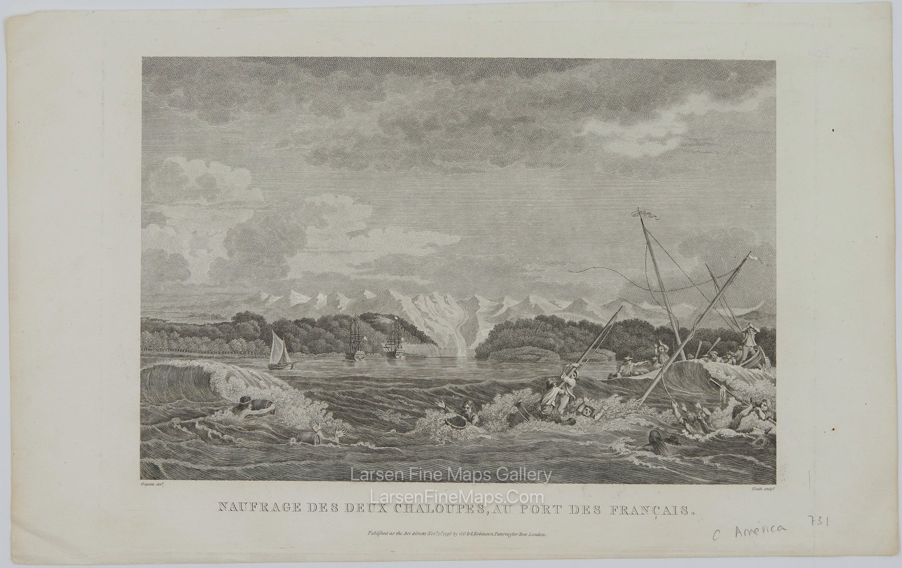
Naufrage des deux chaloupes, au Port des Francais.
DESCRIPTION
A striking, highly decorative, unusual copper-engraved large chart of Lituya Bay is located within Glacier Bay National Park, along Alaska's southeastern coast. This is the English edition by G.G. & I. Robinson and, therefore, a bit smaller than the French edition.
La Perouse discovered the bay in 1786 and named it Port des Francais. He hoped to make it France's major port in the Pacific Northwest and described it as "perhaps the most extraordinary place in the world." He soon discovered what makes the idyllic bay famous today: high (10-foot) tides and strong (14 mph) tidal currents. Twenty-one of La Perouse's men perished in the tidal currents while they were attempting to sound the waters at the narrow entrance. La Perouse built a monument to the lost men on the island in the center of the bay, which he named Cenotaph (meaning empty tomb) Island.
FULL TITLE
MAPMAKER/CARTOGRAPHER/AUTHOR
PUBLISHER
PUBLICATION
DIMENSIONS (Inches)
CONDITION