
YEAR PUBLISHED: 1762
Neu-vermehrte Post-Charte durch gantz Teutschland / Postarum seu Veredariorum Stationes per Germaniam et Provincias Adiacentes.
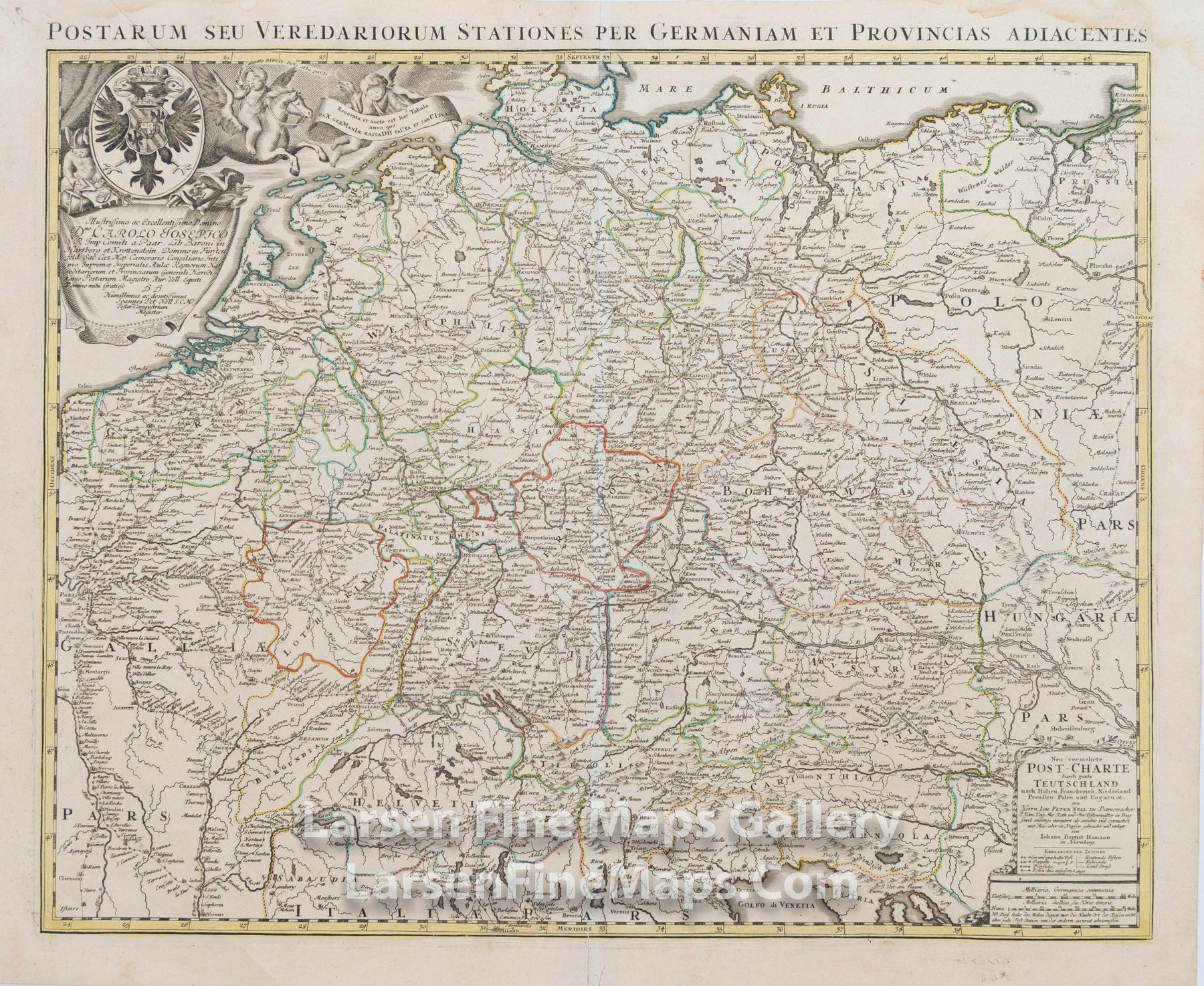
DESCRIPTION
This is a beautiful and striking example of Homann's map of the postal routes through Germany and Central Europe. The map is beautifully hand-colored in outline and wash as published. The covered region shows all of France and portions of the neighboring countries. The map shows relief, towns, fortifications, churches, and other information pictorially, along with a decorative cartouche in the upper left and a title block in the lower right. A second title is shown along the top margin.
FULL TITLE
MAPMAKER/CARTOGRAPHER/AUTHOR
PUBLISHER
PUBLICATION
DIMENSIONS (Inches)
CONDITION